
You save for months to visit a National park, only to discover campground fees cost more than gas money, and every site is booked until next year.
National park camping has become a luxury expense that prices out regular travelers. Campground fees run $30-50 per night, and reservations fill up 5-6 months in advance through Recreation.gov’s lottery system.
If you miss that limited booking window, you’re stuck paying $80-120 at overcrowded private RV parks or sleeping in Walmart parking lots hours from the park entrance.
What most visitors don’t know is that legal free camping exists within minutes of almost every major national park. You just need to know where to look.
In this guide, you’ll discover 11 specific national parks with nearby legal stealth camping spots, complete with exact GPS coordinates, road conditions, and safety considerations.
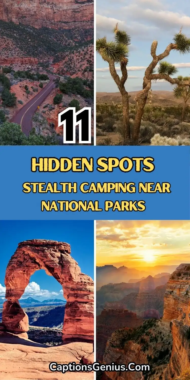
Stealth Camping Near National Parks: 11 Hidden Spots In The United States
What Makes Stealth Camping Legal (And What Doesn’t)
Legal stealth camping isn’t about hiding from authorities; it’s about using designated public lands correctly. The difference between legal dispersed camping in national parks and illegal camping comes down to location and following established rules.
BLM and Forest Service Land Rules
Over 640 million acres of public land allow free dispersed camping, but each agency has specific regulations. Bureau of Land Management areas typically allow 14-day stays before you must move 25 miles away. National Forest Service lands follow similar rules but may have seasonal restrictions or fire closures.
Both agencies require camping at least 200 feet from water sources, roads, and developed facilities. You can’t camp in designated wilderness areas, archaeological sites, or anywhere with “No Camping” signs posted.
Legal Stealth Camping Research Tools
Apps like Campendium crowd-source actual camping spots with user reviews and photos. FreeRoam shows exact BLM and Forest Service boundaries using offline GPS maps. GaiaGPS provides detailed forest service roads and elevation data for access planning.
Cross-reference multiple sources before committing to a spot. What looks perfect on satellite imagery might be private property or seasonally closed.
Red Flags for Illegal Camping
Skip any spot within 100 yards of private property, even if it looks like public land. Avoid areas with fresh “No Trespassing” or “Posted” signs, locked gates, or recent tire tracks leading to secluded areas that feel “too good to be true.”
Never camp in national park boundaries without permits, state park property, or anywhere posted signs prohibit overnight parking.
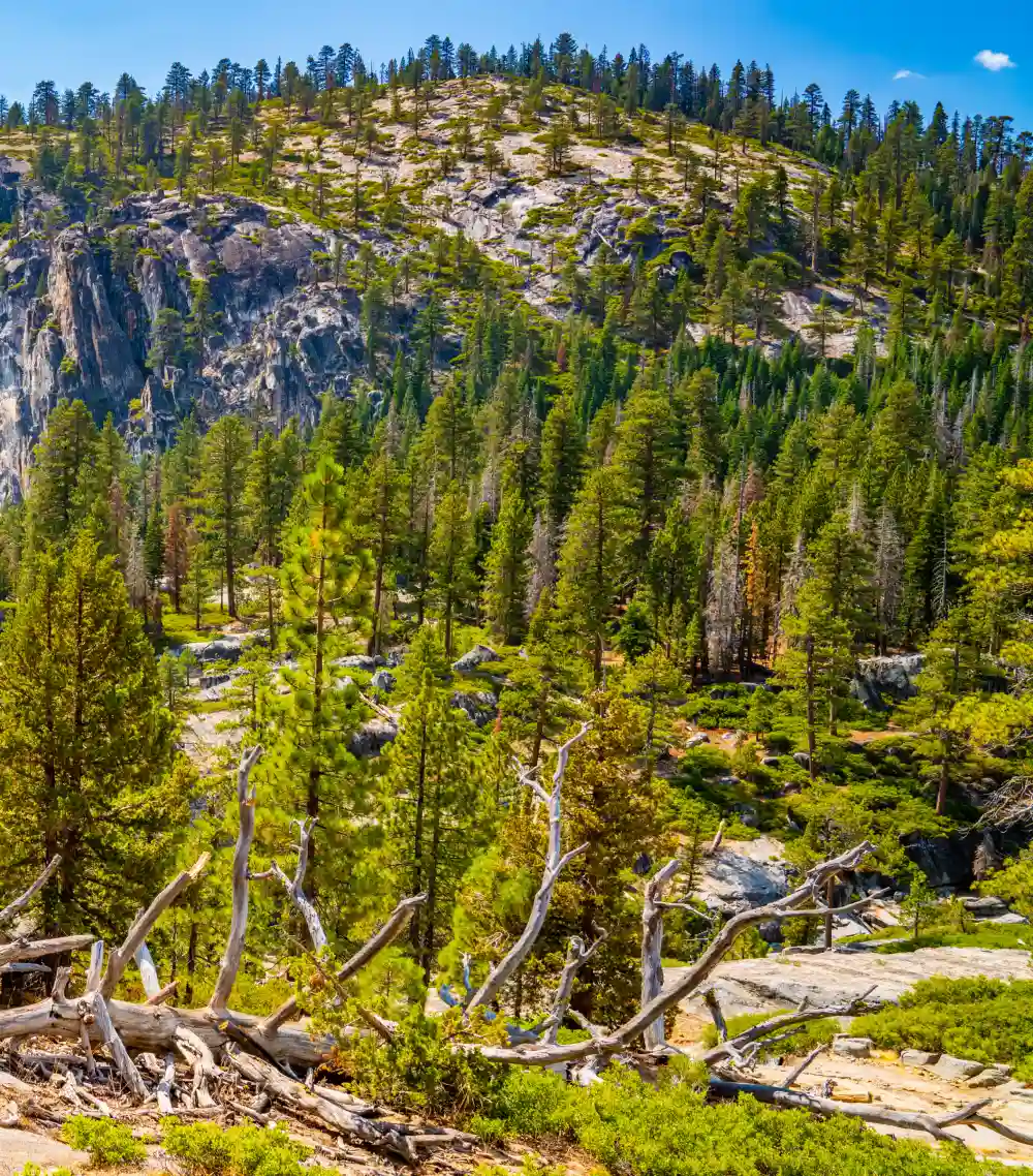
1. Yellowstone National Park – Gallatin National Forest
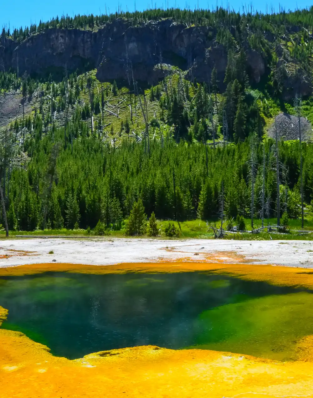
Yellowstone campgrounds cost $32-47 per night and book solid from May through September. Save $45 nightly by camping in Gallatin National Forest, where scattered sites sit just minutes from park entrances.
Three Prime Stealth Camping Yellowstone Locations are:
Forest Road 167 (45.005°N, 111.235°W): Forest Road 167 sits eight miles from Yellowstone’s West Entrance via Highway 20, with a well-maintained gravel road that accommodates RVs up to 35 feet. Multiple pull-offs feature established fire rings and stream access for water filtration.
Hebgen Lake Area (44.863°N, 111.356°W): The Hebgen Lake area sits fifteen miles from Yellowstone’s West Entrance, accessible via paved road followed by a quarter-mile dirt track to lakeside camping spots.
iii. Taylor Fork Road (45.235°N, 110.956°W): Taylor Fork Road lies twelve miles from Yellowstone’s North Entrance through Gardiner, with a rough dirt road that requires high clearance vehicles.
Seasonal Access and Conditions
May through October offers reliable access to all three areas. Spring brings muddy conditions but fewer crowds. Summer means dust and more visitors. Fall delivers perfect weather and golden aspen colors. Winter access depends on snowfall. Forest Road 167 stays open the longest, usually until December.
Nearby Amenities
West Yellowstone (8 miles from Forest Road 167) has full grocery stores, gas stations, and RV dump stations. Gardiner (12 miles from Taylor Fork) offers basic supplies and the famous Roosevelt Arch photo opportunity.
The Hebgen Lake area includes a marina with fuel and limited supplies, plus several restaurants popular with locals. These free camping Yellowstone spots put you closer to geysers and wildlife than most paid campgrounds inside the park.
2. Grand Canyon – Kaibab National Forest
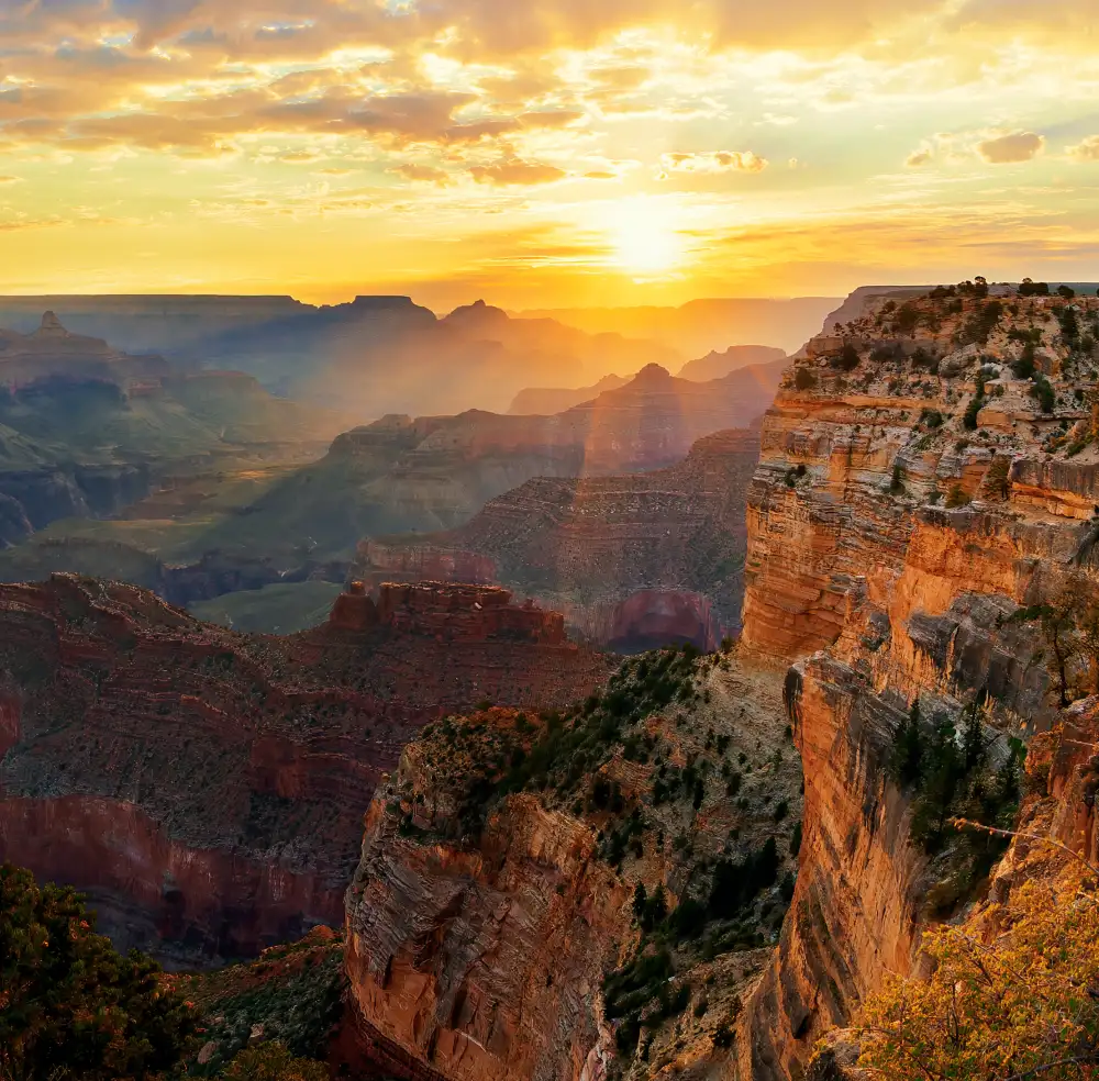
Grand Canyon campgrounds charge $35 per night and fill up 5 months ahead. Kaibab National Forest offers Grand Canyon stealth camping options on both the popular South Rim and remote North Rim sides.
South Rim Dispersed Camping (More Crowded, Year-Round Access)
Forest Road 688: Forest Road 688 extends ten miles from Grand Canyon Village via Highway 64, featuring a wide, maintained gravel road that accommodates large RVs. Multiple established camping areas offer existing fire rings, though no water sources are available on-site.
Ten-X Area: The Ten-X area sits four miles from Grand Canyon’s South Entrance, where a former developed campground now provides free dispersed camping. Level sites accommodate any rig size and still feature maintained vault toilets.
North Rim Options (Fewer People, Seasonal Access Only)
Point Sublime Road: Point Sublime Road stretches seventeen miles from the North Rim Visitor Center via a rough dirt road requiring high-clearance vehicles only. The challenging access rewards campers with sites literally on the canyon rim, offering unobstructed sunrise views.
Elevation and Seasonal Considerations
South Rim sites sit at 7,000 feet. Expect snow from November through March, but roads stay open. North Rim areas reach 8,000+ feet and close completely from October through May due to heavy snow.
Summer temperatures at the South Rim hit 80s during the day, 40s at night. North Rim stays 10-15 degrees cooler.
Fire Restrictions and Water
Stage 2 fire restrictions ban campfires from May through September, most years. Bring a camp stove for cooking. No water sources exist at dispersed sites; carry everything you need.
The closest water and dump stations are inside Grand Canyon Village, 20 minutes from Forest Road 688 sites. Arizona dispersed camping rules allow 14-day stays, then you must move 25 miles away.
3. Zion National Park – BLM and Dixie National Forest
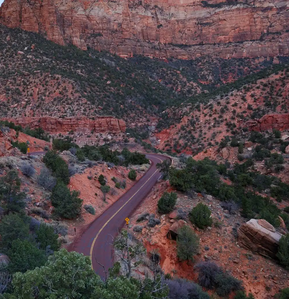
Zion campgrounds cost $35-40 per night and book 3 months ahead through their lottery system. Skip the stress with Zion free camping on surrounding public lands that often offer better views than inside the park.
Hurricane Cliffs BLM Area (Prime Desert Camping)
Hurricane Cliffs: It sits fifteen miles from Zion’s South Entrance via Highway 9, encompassing a massive BLM area with hundreds of dispersed camping spots. Red rock formations throughout the area create natural windbreaks and privacy for campers.
Road conditions vary from paved to sandy. Stick to established tracks to avoid getting stuck. Any rig size works if you choose your spot carefully.
Kolob Canyons Area Forest Service Camping
Kolob Terrace Road: Kolob Terrace Road provides access via Virgin, Utah, where higher elevation delivers cooler temperatures and different scenery than desert areas. Several pullouts between mile markers 8-15 offer suitable camping spots for various rig sizes.
Gooseberry Mesa: Gooseberry Mesa requires advanced access only, with a steep, rocky road demanding 4WD and high clearance vehicles. This mountain biking paradise offers camping directly on slickrock formations for experienced adventurers.
Temperature Considerations
Hurricane Cliffs sits at 3,000 feet. Summer daytime temperatures hit 100°F+ while nights cool to 70s. Winter days reach the pleasant 60s with freezing nights possible.
Kolob Terrace camping sits at 6,000+ feet. Summer highs reach 80s with comfortable 50-degree nights. Winter brings snow and road closures above 7,000 feet.
Shuttle Access and Logistics
Hurricane Cliffs puts you 25 minutes from Zion’s shuttle system in Springdale. Kolob Terrace offers direct access to the less-crowded Kolob Canyons section of the park – no shuttle required.
Rock Climbing Ethics
Many Utah boondocking areas double as climbing destinations. Camp away from cliff bases and popular boulder problems. Pack out all trash, including tape and chalk bags climbers sometimes leave behind.
The 14-day BLM limit applies, but the Hurricane Cliffs area is massive enough to move spots without leaving the general area.
4. Joshua Tree – BLM Surrounding Areas
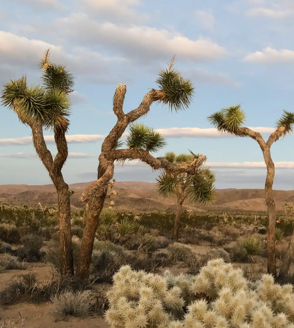
Joshua Tree campgrounds cost $25 per night and fill during peak season (October-April). The surrounding California desert camping offers more space, better stargazing, and zero crowds.
14-Day Limit Strategies
BLM areas around Joshua Tree strictly enforce 14-day limits with regular ranger patrols. Plan your rotation between multiple areas: Cholla Cactus Garden road, Pinto Basin area, and Queen Valley sites all offer different experiences.
Move at least 25 miles between locations. Use apps like FreeRoam to track exact boundaries and avoid accidentally camping in the same 14-day area.
Best Areas for Different Activities
Stargazing: Lucerne Valley BLM (34.465°N, 116.958°W) sits in a designated Dark Sky area. Minimal light pollution and wide-open spaces are excellent for astronomy. Any rig size works on a flat, hard-packed desert floor.
Rock Climbing: Queen Valley (34.032°N, 116.145°W) puts you within walking distance of world-class bouldering. Established camping areas already exist near popular climbing zones.
Photography: Cholla Cactus Garden Road dispersed sites (33.913°N, 115.924°W) offer sunrise shots of the Salton Sea and desert mountains. Paved access road works for any vehicle.
Water and Supply Considerations
No water exists at any dispersed sites. The nearest supplies are in Twentynine Palms (north entrance) or Desert Hot Springs (west side). Plan for 45-60 minute drives to resupply.
Carry extra water for radiator emergencies. Desert heat kills car batteries and causes overheating without warning.
Generator Hours and Noise Restrictions
Most BLM areas allow generators from 8 AM to 6 PM only. But many Joshua Tree boondocking spots sit close enough to each other that generator noise carries far in the thin desert air.
Weather Safety
Flash flood danger exists from October through March. Never camp in washes, even if they look completely dry. Desert storms drop inches of rain in minutes, creating deadly torrents.
Summer temperatures exceed 110°F regularly. April through September camping requires serious heat preparation and extra water storage.
5. Glacier National Park – Flathead National Forest
Glacier’s campgrounds cost $23-42 per night and book 5 months ahead. Going-to-the-Sun Road closes to RVs over 21 feet, but Glacier National Park free camping in the surrounding Flathead National Forest works for any rig size.
Seasonal Access Reality
Going-to-the-Sun Road fully opens from July through September only. Snow blocks high-elevation sections from October through June. This limits camping options and creates massive crowds during the short season.
Plan for Montana dispersed camping from May through October. Winter access requires serious cold-weather gear and experience.
West Entrance Camping Options
North Fork Flathead River Area (48.672°N, 114.089°W): The North Fork Flathead River area lies twenty miles from Glacier’s West Entrance via paved Forest Road. River access offers excellent fishing for cutthroat trout and whitefish. Current is strong – secure all gear.
East Entrance Options
Two Medicine Area Forest Roads (48.485°N, 113.356°W): The Two Medicine Area forest roads extend fifteen miles from Glacier’s park boundary, where gravel roads require careful navigation. Several lakes sit within hiking distance of camping areas, though black bear activity is common and requires strict food storage compliance.
Bear Safety Requirements
All food, toiletries, and scented items must be stored in hard-sided vehicles or bear canisters. Flathead National Forest provides bear boxes at some sites, but don’t count on them. Cook and eat at least 100 yards from your sleeping area. Clean dishes immediately and store grey water in sealed containers.
Fishing Opportunities
A Montana fishing license is required for all waters. Native fish populations are protected; learn identification and regulations before wetting a line. Best fishing happens early morning and evening when tourist traffic decreases inside the park.
Weather Preparation
Mountain weather changes fast. Snow is possible in any month above 5,000 feet elevation. Pack warm layers even for summer camping.
Afternoon thunderstorms are common in July and August. Set up camp with lightning safety in mind; avoid ridge tops and isolated trees.
6. Arches/Canyonlands – Moab BLM Areas
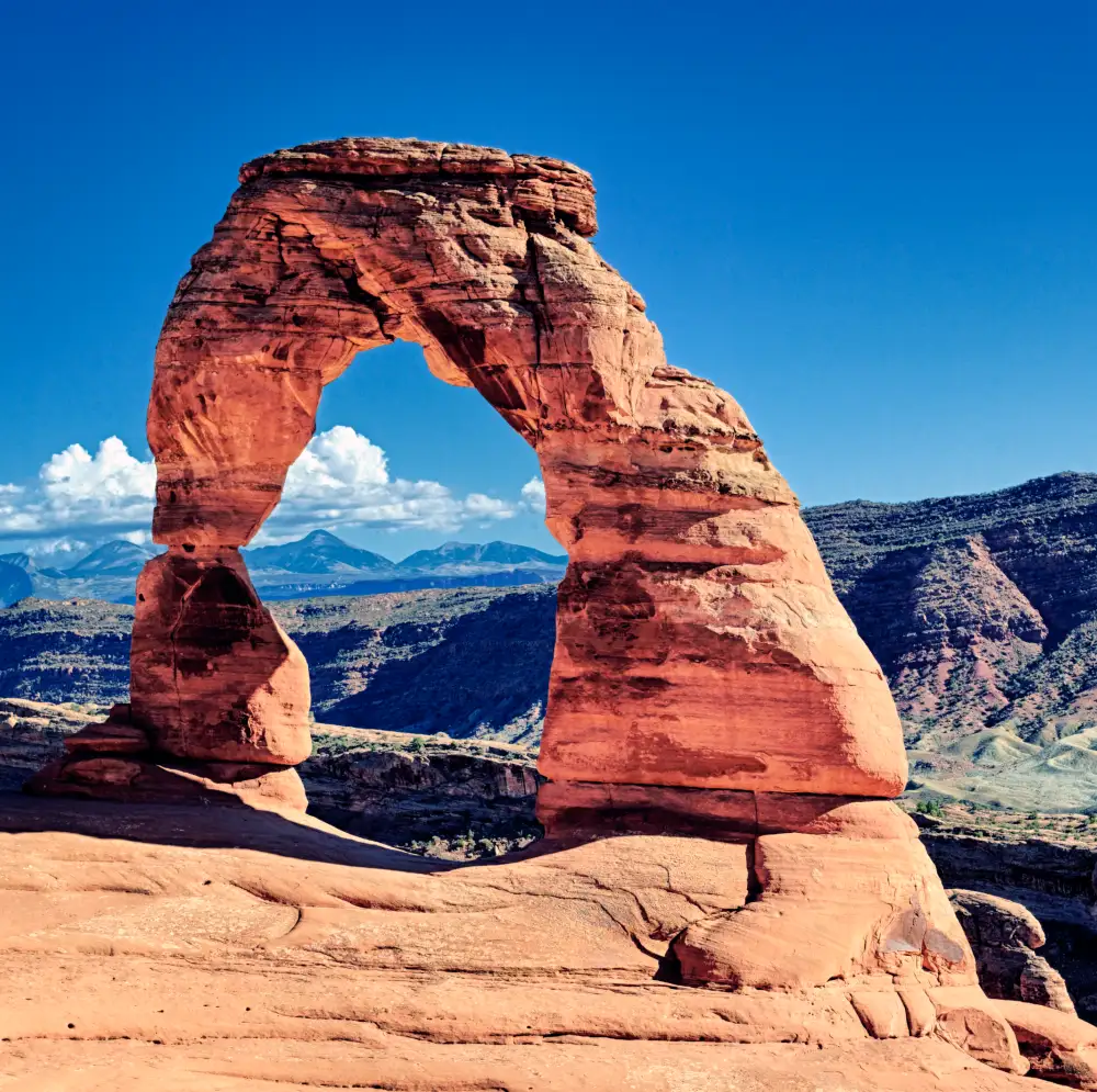
Moab’s developed campgrounds charge $35+ per night and fill months ahead. The surrounding Utah BLM camping offers red rock scenery that rivals anything inside the parks.
Popular vs Hidden Camping Areas
Popular (Crowded but Easy Access): Sand Flats Recreation Area requires $15 permits but offers established sites near Delicate Arch. Boondock camping is available beyond the fee area.
Hidden Gems:
i. Klondike Bluffs (38.783°N, 109.662°W): Klondike Bluffs sits thirty minutes from the Arches entrance via a maintained dirt road, offering the same red rock formations. Multiple camping areas spread across several square miles provide plenty of space and solitude.
ii. Long Canyon (38.592°N, 109.456°W): Long Canyon requires advanced access with high-clearance 4WD vehicles only. The challenging route rewards adventurous campers with sites inside slot canyon walls offering complete privacy.
Mountain Biking Trail Access
Many Moab boondocking sites put you at trailheads for world-famous mountain biking. Slickrock Trail, Porcupine Rim, and Captain Ahab routes all have nearby camping options.
Respect trail systems and camp only in designated areas. Mountain biking creates erosion; camping in the wrong spots makes it worse.
Rock Formations and Natural Landmarks
Corona Arch Area (38.585°N, 109.547°W): This area offers dispersed camping below the popular arch hiking trail. Red rock spires throughout the area provide natural windbreaks and privacy screens for campers.
Fisher Towers (38.718°N, 109.309°W): It provides camping among 900-foot sandstone towers via paved access road, followed by short dirt sections to established sites. The dramatic geological formations create a unique camping experience with relatively easy access.
Permit Requirements
Most BLM areas around Moab don’t require permits for dispersed camping. But popular spots like Sand Flats charge fees to control crowds and fund maintenance. Check current regulations. Moab’s popularity has led to new restrictions in recent years.
Best Seasons to Avoid Crowds
March-May and September-November bring excellent weather but maximum crowds. Summer heat (100°F+) drives most people away but makes camping miserable without shade.
Winter offers solitude and mild daytime temperatures, but freezing nights require serious gear.
7. Great Smoky Mountains – Cherokee and Pisgah National Forests
Smoky Mountains campgrounds cost $25-27 per night and book solid during leaf season. Cherokee and Pisgah National Forests offer the Smoky Mountains free camping with mountain views and fewer crowds.
Tennessee vs North Carolina Side Options
Tennessee Side (Cherokee National Forest): Tellico Plains Area (35.365°N, 84.285°W):
The Tellico Plains area sits forty-five minutes from Gatlinburg via the scenic Cherohala Skyway. Forest roads require careful guiding but reward campers with stream-side sites and established fire rings.
North Carolina Side (Pisgah National Forest): Cataloochee Valley Area (35.595°N, 83.065°W):
The Cataloochee Valley area provides a remote entrance to the Smokies with excellent elk viewing opportunities. This location offers fewer crowds than the Tennessee side but requires a longer drive to reach the main park attractions.
Elevation and Temperature Differences
Valley camping (2,000-3,000 feet) stays 10-15 degrees warmer than ridge camping (4,000+ feet). Summer valley temperatures hit 80s-90s with high humidity. Mountain camping offers relief with 70s highs and 50s nights.
Winter brings possible snow above 3,000 feet. Ice on mountain roads makes access dangerous without 4WD.
Seasonal Considerations
Leaf Season (Late September-Mid October): Peak crowds everywhere. Arrive on weekdays if possible. Colors peak at different elevations because higher elevations change first.
Summer: Hot and humid in the valleys. Mountain camping offers better comfort. Thunderstorms are common afternoon/evening.
Winter: Quiet and peaceful, but cold. Some forest roads close due to ice/snow.
Appalachian Trail Access
Several Appalachian dispersed camping spots provide direct trail access. Popular sections like Clingmans Dome and Charlies Bunion become day hikes instead of overnight backpacking trips.
Follow Leave No Trace principles strictly.
Regional Wildlife Precautions
Black bears are common but generally avoid humans. Store all food in hard-sided vehicles. Don’t leave coolers, toiletries, or scented items in tents.
Venomous snakes (copperheads, timber rattlers) inhabit lower elevations. Watch where you step, especially around rock piles and fallen logs.
8. Yosemite – Sierra and Stanislaus National Forests
Yosemite campgrounds cost $36 per night and book instantly when reservations open. Sierra and Stanislaus National Forests offer Yosemite stealth camping with better access to less-crowded park entrances.
Seasonal Road Closures
Tioga Pass (Highway 120 East) closes from October through May due to snow. This eliminates access to high-country dispersed camping but opens up winter opportunities at lower elevations.
Monitor Caltrans road conditions before heading to mountain forest roads. Chains are required on many routes during winter.
Dispersed Camping by Park Entrance
West Entrance (Highway 120): Groveland Ranger District (37.835°N, 120.158°W): Multiple forest roads branch off Highway 120. Big Oak Flat Road offers several established camping areas within 30 minutes of the park entrance.
South Entrance (Highway 41): Bass Lake Area (37.327°N, 119.568°W): Developed and dispersed camping options around the lake. Paved access roads work for any rig size. Twenty-five miles from the Wawona entrance.
East Entrance (Tioga Pass – Seasonal): Inyo National Forest (37.946°N, 119.254°W): High-elevation camping at 8,000+ feet. Spectacular scenery but requires mountain driving skills and cold-weather gear.
Fire Restrictions
California forests implement fire restrictions from May through October most years. Stage 1 restrictions allow campfires in established rings only. Stage 2 bans all fires, including charcoal.
Check current restrictions before arriving. Violations carry serious fines and potential criminal charges during high fire danger.
Alternative Access During Park Closures
When Yosemite’s internal roads close for snow or maintenance, Sierra Nevada boondocking spots provide access to park boundaries for hiking and photography.
Winter camping offers different experiences – frozen waterfalls, snow-covered domes, and empty trails normally packed with tourists.
Photography Locations
Many forest camping areas offer direct access to photography locations rivaling famous park viewpoints. Glacier Point Road alternatives exist on forest service lands without park crowds.
Sunrise and sunset shots work better from outside the park boundaries, where you can position freely without fighting for parking spots.
9. Olympic National Park – Olympic National Forest
Olympic’s campgrounds cost $25-35 per night during peak season. Olympic Peninsula free camping in the surrounding national forest offers coastal and mountain options with fewer crowds and restrictions.
Coastal vs Mountain Forest Camping
Coastal Options: Kalaloch Area Forest Roads (47.615°N, 124.365°W): There is beach access without park campground crowds. Established camping areas are in coastal forest with stream access.
Mountain Forest Camping: Sol Duc Area (47.952°N, 123.845°W): It provides higher elevation camping with old-growth forest and mountain views. The gravel forest roads require careful steering but handle most RVs.
Rain Preparation
Western Washington gets 100+ inches of rain annually. Waterproof everything. Tarps, extra stakes, and quality rain gear aren’t optional. They’re survival equipment.
Set up camp with drainage in mind. Avoid low spots where water collects. Test all zippers and seams before leaving home.
Coastal Camping Tide Safety
Beach camping areas face serious tide dangers. Research tide tables and tsunami evacuation routes before choosing coastal sites.
Never turn your back on ocean waves. Sneaker waves kill people regularly on Pacific Northwest beaches. Camp well above high tide lines.
Hot Springs Access
Several Olympic Peninsula forest camping areas provide access to natural hot springs. Sol Duc and Olympic Hot Springs require hiking but offer clothing-optional soaking without crowds.
Respect these fragile ecosystems. Use biodegradable soap only and pack out all trash.
Logging Road Navigation
Olympic National Forest contains thousands of miles of logging roads. Many are unmarked or poorly maintained. Download offline maps and carry physical backups.
Road conditions change seasonally. Spring washouts and winter closures happen regularly. Check with ranger stations for current access information.
10. Rocky Mountain – Roosevelt National Forest
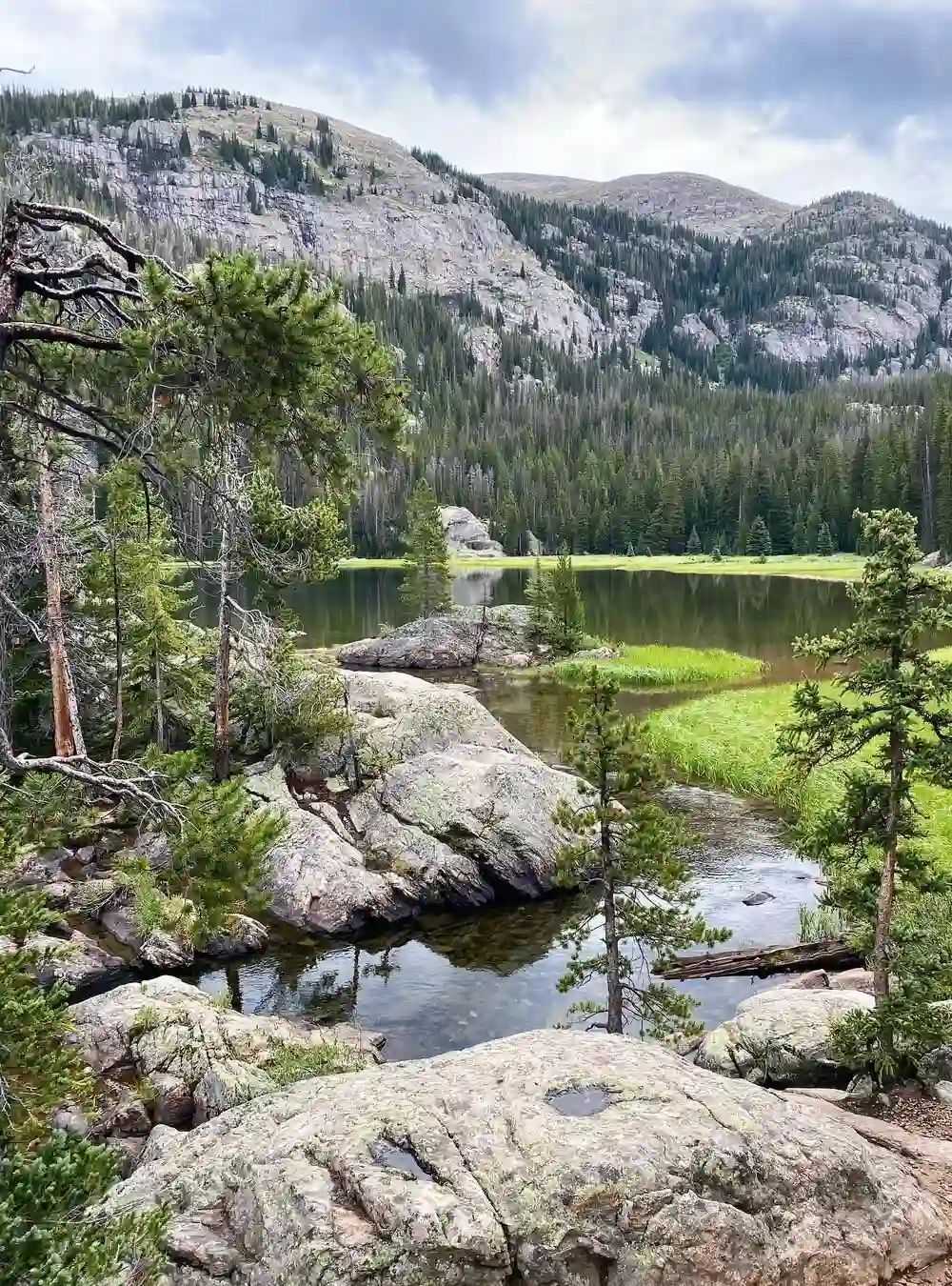
Rocky Mountain campgrounds cost $32 per night and book 5 months ahead. Roosevelt National Forest provides Colorado high country camping with better wildlife viewing and fewer crowds than inside the park.
High Altitude Considerations
Most dispersed camping is above 8,000 feet elevation. Altitude sickness affects some people; symptoms include headaches, nausea, and fatigue. Ascend gradually and stay hydrated.
Water boils at lower temperatures, affecting cooking times. Alcohol hits harder at altitude. UV exposure increases significantly so sunscreen and sunglasses are essential.
Seasonal Accessibility
Summer (July-September): All areas accessible, but afternoon thunderstorms bring lightning danger. Start hiking early, return to camp by noon.
Fall (October-November): Beautiful aspen colors but possible snow above 9,000 feet. Chain requirements on mountain roads.
Winter (December-March): Many forest roads close completely. Accessible camping requires 4WD and winter survival skills.
Spring (April-June): Muddy conditions, unpredictable weather. Some roads remain closed until snowmelt completes.
Dispersed Camping by Park Entrance
Estes Park Side: Long Draw Road (40.415°N, 105.598°W): Multiple camping areas are along the reservoir. Good fishing and mountain views. RVs up to 30 feet on a maintained gravel road.
Grand Lake Side: Stillwater Campground Area (40.215°N, 105.785°W): The Western entrance is less crowded. Several dispersed sites are near an established campground.
Wildlife Safety
Black Bears: Common throughout Roosevelt National Forest. Store all food in hard-sided vehicles or bear canisters. Cook away from sleeping areas.
Mountain Lions: Present but rarely seen. Make noise while hiking. Don’t hike alone at dawn/dusk.
Elk: Massive animals that can weigh 800+ pounds. Give them a wide berth, especially during the fall mating season when bulls become aggressive.
Weather Preparation
Mountain weather changes in minutes. Snow is possible any month above 9,000 feet. Pack layers; shorts and winter coats might both be needed on the same day.
Lightning storms build quickly on summer afternoons. Seek shelter in vehicles, not under trees. Avoid ridge tops and open meadows during storms.
11. Bryce Canyon – Dixie National Forest
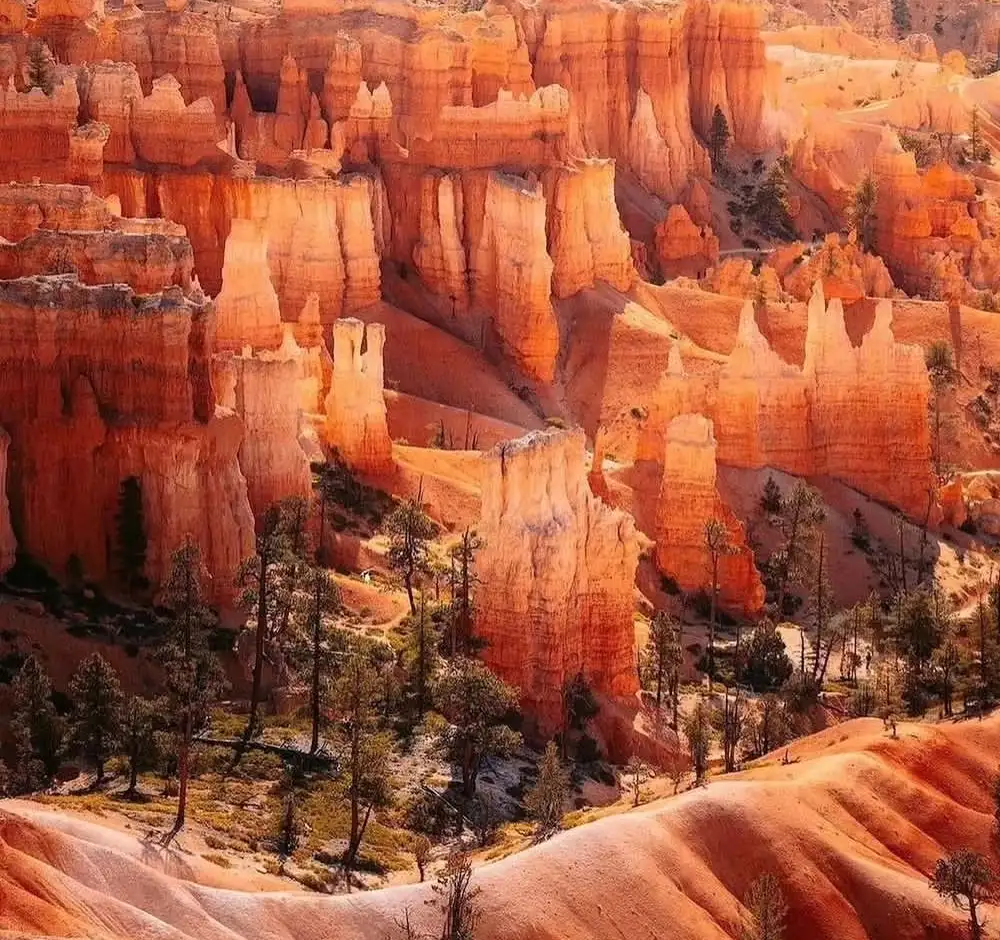
Bryce Canyon campgrounds cost $35 per night and book months ahead. Dixie National Forest offers Bryce Canyon boondocking with the same red rock scenery and better dark sky viewing.
Red Canyon Area Dispersed Camping
Red Canyon (37.695°N, 112.315°W): It is ten miles from Bryce Canyon entrance via Highway 12. Multiple established camping areas among red rock formations are identical to those inside the park.
Paved access roads handle any rig size. Vault toilets are available at some sites. There is no water, so bring everything you need.
Elevation and Seasonal Access
Bryce Canyon sits at 8,000+ feet elevation. Summer daytime temperatures reach comfortable 70s-80s, but nights drop to 40s even in July.
Winter brings heavy snow and road closures. Camping season runs from May through October reliably. November and April depend on weather patterns.
Dark Sky Opportunities
The Bryce Canyon area earned a Dark Sky designation for exceptional stargazing. Light pollution is minimal, making this perfect for Utah red rock camping under brilliant night skies.
Milky Way photography peaks from June through September when the galactic center is visible. New moon periods offer the darkest skies for astronomy.
Hiking Trail Connections
Several forest camping areas provide direct access to hiking trails that connect with Bryce Canyon’s famous hoodoo formations. The Pink Cliffs Trail and Red Canyon Trail offer park-quality scenery without entrance fees.
Water and Supply Logistics
No water sources exist at dispersed camping areas. Nearest supplies are in Bryce Canyon City (limited selection) or Cedar City (45 minutes, full services). Plan carefully, as this remote location means long drives for forgotten essentials. Cell phone coverage is spotty throughout the area.
The 14-day limit applies, but the Dixie National Forest camping area is large enough to move spots without major inconvenience.
Stealth Camping Etiquette and Safety Tips
Bad stealth campers ruin it for everyone else. Their trash, loud generators, and disrespectful behavior lead to camping bans that affect all future travelers.
Leave No Trace for Dispersed Camping
Pack out everything you bring in, including grey water from washing dishes. Don’t dump soapy water on the ground – it kills plants and attracts animals to future camping spots.
Use existing fire rings instead of building new ones. If no fire ring exists, use a portable fire pan or skip the fire entirely. Scatter cold ashes widely, never bury them.
Camp in already-disturbed areas rather than pristine meadows. Your goal is to leave zero evidence you were ever there.
How to Stay Invisible
Arrive after dark and leave before sunrise when possible. This minimizes your visibility to rangers and other campers who might complain about overcrowding.
Choose campsites behind natural screens like rocks or trees. Avoid open meadows or ridgetops where your camp is visible from roads.
Use earth-tone gear instead of bright colors that stand out. Keep noise levels down. Voices carry far in quiet wilderness areas. Skip the generator if you can manage with solar power and battery banks.
Solo Traveler Safety Protocols
Tell someone your exact camping location and expected return date. Share GPS coordinates, not just “somewhere near Yellowstone.”
Carry two forms of communication: a cell phone plus a satellite communicator or emergency beacon. Cell towers don’t work everywhere, but satellites do.
Trust your instincts about camping locations. If something feels wrong, move to a different spot, even if it means driving in the dark.
Emergency Communication Plans
Download offline maps before losing cell signal. GPS works without cell coverage, but map apps need data for route planning.
Keep emergency contact numbers written on paper. Dead phone batteries happen at the worst times.
Know the closest hospital and ranger station locations. Emergency services response times in remote areas can exceed two hours.
Respecting Communities and Private Property
Don’t camp on private land without permission, even if it looks abandoned. Trespassing charges stick and create problems for future responsible stealth camping.
Buy supplies, gas, and food in local communities when possible. These small towns depend on tourism dollars and appreciate respectful visitors.
Follow local noise ordinances and generator restrictions. What’s legal on public land might violate city rules if you’re near populated areas.
Practice dispersed camping ethics even when nobody’s watching. The future of free camping depends on proving that responsible stealth camping works.
Start Your Free Camping Adventure
These 11 parks save $30-50 nightly compared to developed campgrounds – that’s $210-350 per week. Research locations first. Download offline maps, pack extra water, and emergency communications. Plan for weather and seasonal closures.
Follow Leave No Trace principles. Rangers close areas that get trashed. Your actions determine whether stealth camping near national parks stays available. Pick familiar parks first. Focus on camping skills without worrying about getting lost.
Share responsibly. Don’t broadcast exact locations on social media; good spots get ruined by crowds. Free camping near national parks requires planning and respect. The best park experiences often happen outside official boundaries.
Essential Gear for Safe Stealth Camping
Stealth camping success depends on self-sufficiency. Unlike developed campgrounds, you won’t have water spigots, electrical hookups, or bathroom facilities nearby.
Water Storage and Filtration Systems
Carry at least one gallon per person per day, plus extra for cooking and cleaning. Sawyer water filters let you refill from natural sources safely, while larger RVs need 40-100 gallon freshwater tanks for extended stays.
Install a water level monitor so you never run dry unexpectedly. Running out of water 20 miles from the nearest town ruins any camping trip fast.
Solar Power Setups for Extended Stays
Goal Zero solar panels and portable power stations keep phones, GPS devices, and LED lights running without noisy generators. A 100-watt panel with 200Ah battery bank handles basic electronics for 3-4 days without sun.
Skip cheap solar kits from big box stores. Quality boondocking gear pays for itself in reliability when you’re miles from help.
Waste Management Systems
Grey water from sinks and showers must be disposed of properly, not dumped on the ground. Portable grey water tanks or absorption systems prevent environmental damage and legal issues.
For RVs, monitor black tank levels carefully and plan dump station stops. Composting toilets work great for van conversions and smaller rigs.
Communication Devices for Emergencies
WeBoost cell signal boosters extend phone coverage in remote areas, but don’t rely on them completely. Garmin inReach satellite communicators work anywhere for true emergency backup.
Download offline maps before leaving cell coverage. GPS works without cell signal, but mapping apps need data for route planning.
Low-Profile Camping Techniques
Arrive late and leave early to minimize visibility. Choose campsites behind natural screens like rocks or trees rather than open meadows. Use earth-tone gear instead of bright colors that attract attention from roads or trails.
The best stealth camping equipment blends into natural surroundings while keeping you comfortable and safe.