
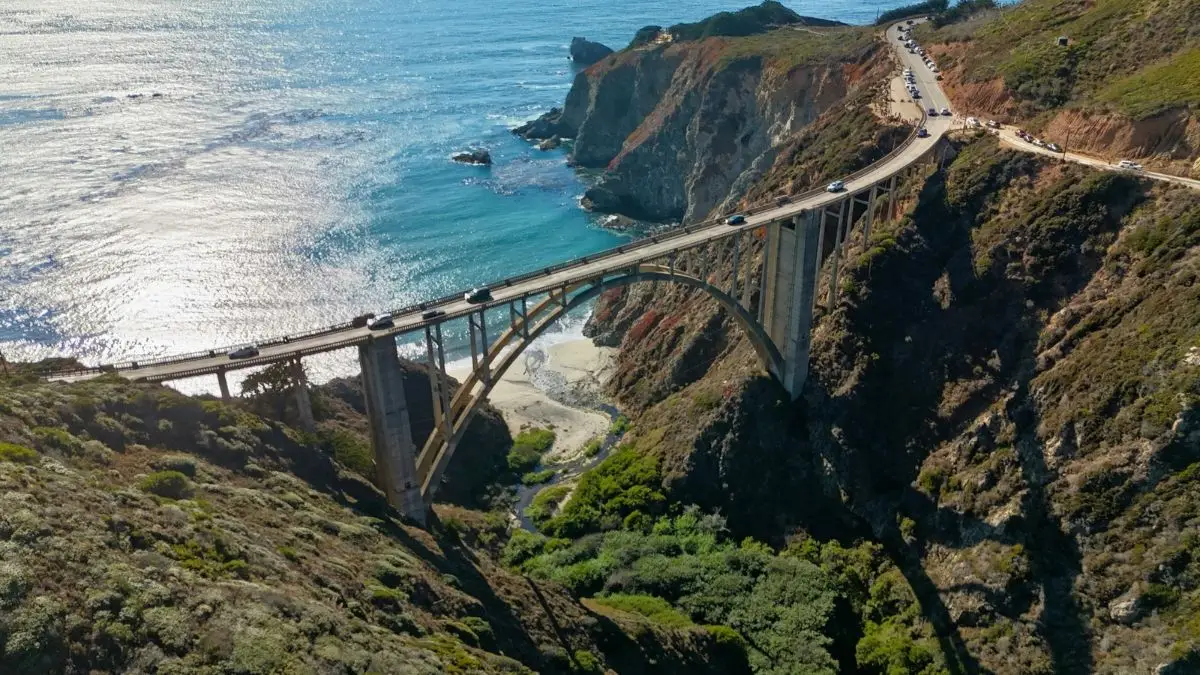
Picking a beautiful road trip is easy. The harder part is knowing when the road is open, where you should stop, and whether crowds or closures could ruin half your day.
That matters with some of the best US road trips. Mountain snow can keep roads closed into early summer. Wildfires, storms, road repairs, and packed parking lots can change a trip with little warning.
These seven summer road trips give you something different. You can drive beside Pacific cliffs, cross the Rockies, pass Utah red rock, or spend several days moving between rainforest and wild beaches.
But this guide is about more than pretty views. You will see how long each trip deserves, which stops are worth your time, what changed in 2026, and what you should check before leaving.
17 US Road Trips You’ll Regret Not Doing This Summer (Save These Routes Before They Blow Up)
| Route | Best summer window | Time to allow | Main reason to go | Check before leaving |
|---|---|---|---|---|
| Big Sur Highway 1 | June to September | 2 to 3 days | Pacific coastline | Fires and road closures |
| Going to the Sun Road | July to early September | 1 to 2 days | Glacier mountains | Road and parking status |
| Scenic Byway 12 | June to September | 2 to 4 days | Utah red rock | Heat and weather |
| Olympic Peninsula | July to September | 3 to 5 days | Coast and rainforest | Parking and road work |
| Tioga Road | June to September | 1 to 3 days | Sierra high country | Snow and services |
| Beartooth Highway | June to September | 1 to 2 days | Alpine scenery | Snow and weather |
| Blue Ridge Parkway | June to September | 3 to 7 days | Appalachian scenery | Current road closures |
1. Big Sur Highway 1 Is Finally a Full Coastal Drive Again
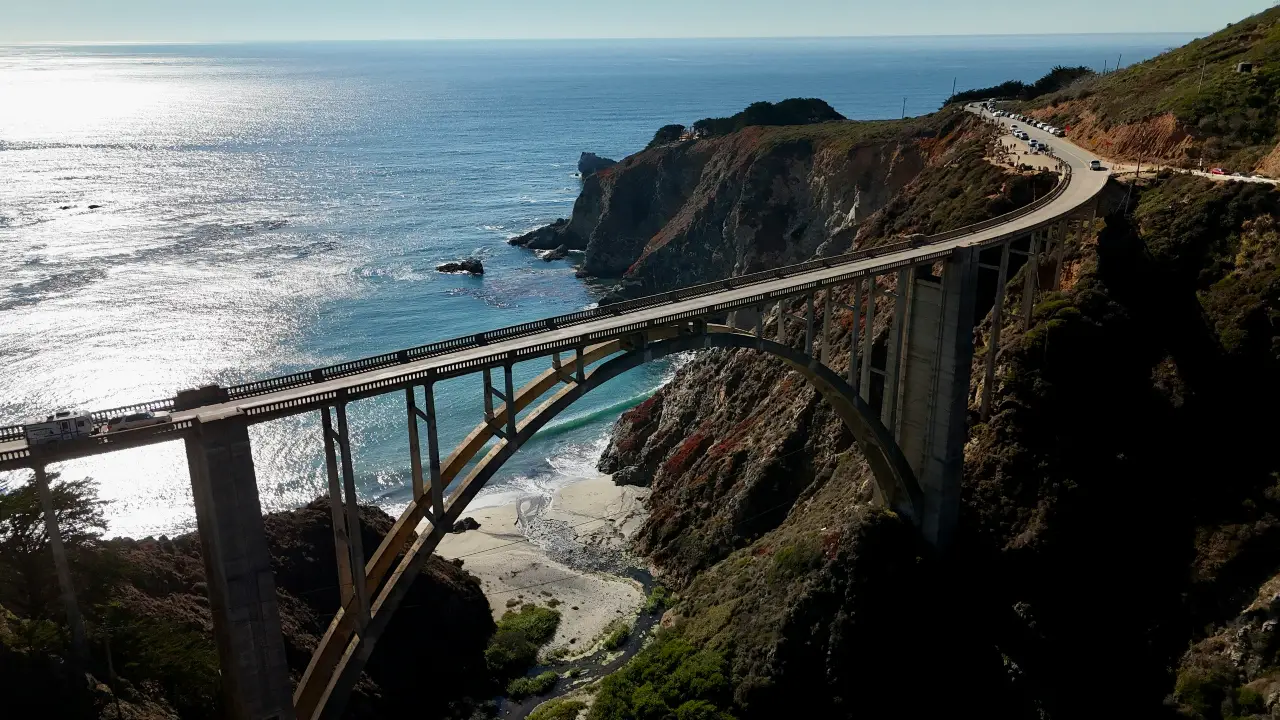
Big Sur is the kind of road where rushing makes little sense. The drive follows about 90 miles of California coast, with cliffs, beaches, redwoods, and ocean views packed into a relatively short distance.
There is also an important reason this route belongs on a 2026 list. Caltrans reopened Highway 1 at Regent’s Slide on January 14, 2026. That restored travel between Carmel and Cambria after the route had been cut by a landslide for almost three years.
Start around Carmel and give yourself at least two days. Stop around Point Lobos, continue into Big Sur, then work south toward Ragged Point and Cambria.
Do not treat the road like a fast connection between two towns. Pullouts, short walks, meals, photography, and traffic can easily fill the day.
Route: Carmel to Big Sur to Cambria
Allow: 2 to 3 days
Best for: Ocean views, short hikes, coastal towns
Good stops: Point Lobos, Big Sur, Ragged Point, Cambria
2026 issue: Fire, storm, and slide closures can still happen
One mistake is assuming that a January reopening means the entire route will stay problem-free all year. Big Sur is still exposed to fires, rockfalls, storms, and slope failures.
Check Caltrans QuickMap on the morning you leave. A route you saved months ago may no longer match the conditions on the ground.
Also be careful around Bixby Creek Bridge. Do not create your own parking spot just to get a photo. Use legal parking and signed viewpoints.
If you have an extra night, stay in or around Big Sur instead of pushing straight to Cambria. The whole point of this California road trip is giving yourself enough time to stop.
2. Going to the Sun Road Gives You 50 Miles of Glacier at Its Best
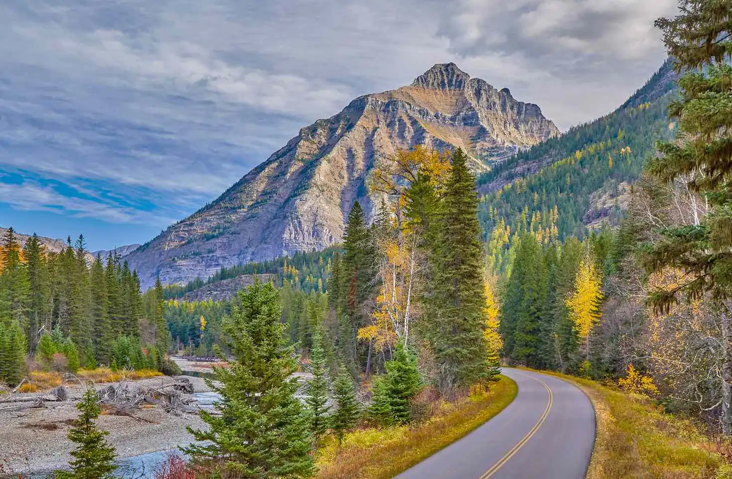
Some roads are open all year. Going to the Sun Road is different.
Snow controls much of its season. Glacier National Park fully opened the roughly 50-mile road on June 22 for the 2026 season, giving drivers access between West Glacier and St. Mary through Logan Pass.
That short season is one reason the road feels special in summer. You climb from forests and lakes into bare mountain country in a single drive.
Start near Lake McDonald if you are coming from the west. Trail of the Cedars makes a useful early stop before the road begins climbing harder.
Then continue past The Loop and up to Logan Pass. On the eastern side, continue toward St. Mary and the Wild Goose Island area.
Route: West Glacier to Logan Pass to St. Mary
Allow: 1 to 2 days
Best for: Mountain scenery, hiking, wildlife
Good stops: Lake McDonald, Trail of the Cedars, The Loop, Logan Pass, St. Mary
2026 issue: Glacier changed access at Logan Pass
Glacier did not require vehicle reservations in 2026. During the main summer period from July 1 through September 7, private parking at Logan Pass was limited to three hours. The park also used a ticketed shuttle for visitors who wanted longer access.
That parking limit ended after September 7, 2026, and Logan Pass returned to regular parking until the alpine road closes for winter.
Your vehicle matters too. Vehicles and vehicle combinations longer than 21 feet or wider than 8 feet are prohibited on the section between Avalanche Creek and Rising Sun.
That makes this one of the US road trips where checking vehicle size before arrival can save you a major headache.
Check Glacier’s official road status before leaving. Even during the normal driving season, heavy rain, snow, rockfall, or other conditions can briefly shut sections of the road.
3. Scenic Byway 12 Turns a Utah Transfer Day Into a Road Trip
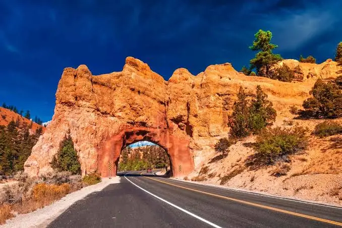
Scenic Byway 12 can look like a road between famous parks. Treat it that way, and you miss most of what makes it good.
Utah lists the route at exactly 122.863 miles. It connects US 89 near Panguitch with State Route 24 near Torrey and has federal All-American Road status.
The drive can connect areas around Bryce Canyon and Capitol Reef, but those parks are only part of the appeal.
You pass red rock, pine forest, small towns, high plateaus, and the open country around Grand Staircase Escalante. Then there is the Hogsback, where the road follows a narrow ridge with steep land dropping away on both sides.
Route: Panguitch area to Bryce area to Escalante to Boulder to Torrey
Allow: 2 to 4 days
Best for: Red rock, desert scenery, photography
Good stops: Red Canyon, Bryce Canyon area, Escalante, Hogsback, Boulder, Torrey
2026 issue: Heat and changing weather can affect the day
A map may make 123 miles seem small. That does not mean you should finish it quickly.
Give yourself one night around Escalante or Boulder. That lets you stop without watching the clock every twenty minutes.
The scenery also changes more than many first-time visitors expect. You can move from hot desert country into much cooler high-elevation areas during the same trip.
Carry more drinking water than you think you need. Fill your fuel tank when you have the chance, especially if you plan to add remote side trips.
Summer heat can make exposed desert walks uncomfortable by midday. Start outdoor stops early and save longer drives for the hotter part of the afternoon.
Among the best summer road trips USA travelers can plan, Highway 12 works especially well when you want several types of scenery without spending most of the day on an interstate.
4. Olympic Peninsula Gives You Mountains, Rainforest, and Wild Coast
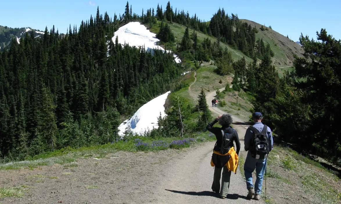
Olympic National Park works differently from many other national parks. You cannot simply drive across its center.
About 95 percent of the park is protected wilderness. Roads enter different parts of the park from around the outside rather than cutting directly across it.
That layout is perfect for a road trip.
Start around Port Angeles. Visit Hurricane Ridge if access is open, then head west toward Lake Crescent.
From there, continue through Forks toward the Pacific coast and the Hoh Rain Forest. Finish farther south around Lake Quinault, or continue the loop depending on how much time you have.
Route: Port Angeles to Lake Crescent to Forks to Pacific coast to Hoh area to Lake Quinault
Allow: 3 to 5 days
Best for: Variety, rainforest, beaches, mountain views
Good stops: Hurricane Ridge, Lake Crescent, Hoh Rain Forest, Pacific beaches, Lake Quinault
2026 issue: Popular parking areas can fill up
The mistake here is trying to fit Hurricane Ridge, the Hoh Rain Forest, and the coast into one packed day.
Summer parking has long been a problem at some of Olympic’s busiest locations. The National Park Service warns that Hurricane Ridge and Hoh Rain Forest parking areas can fill, with waits reaching one or two hours during busy times.
The better plan is simple. Give each part of the peninsula room.
Spend one day around Port Angeles, Hurricane Ridge, and Lake Crescent. Use another for the western beaches and Forks area. Give the Hoh Rain Forest its own early start.
This also makes bad weather easier to handle. If clouds cover the mountains one morning, you can move your coastal plans around instead of losing an entire day.
Keep food, water, and a full fuel tank in mind as well. Services get thinner once you leave the larger towns.
The Olympic Peninsula road trip is less about one famous highway and more about connecting several very different places. That is exactly why three days feels far better than one.
5. Tioga Road Shows You the Yosemite Many Visitors Miss
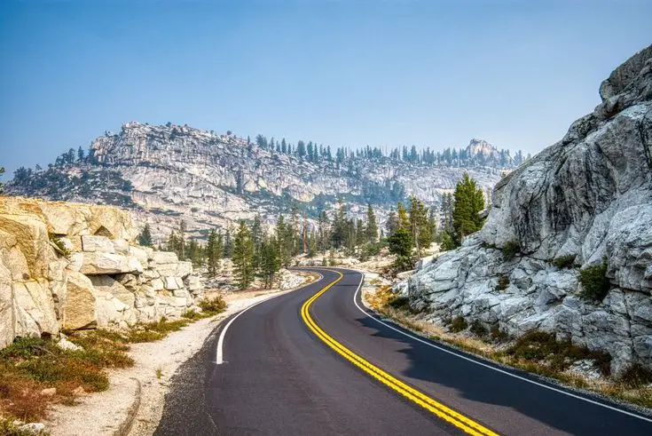
Yosemite Valley gets most of the attention. Tioga Road shows you another side of the park.
The road runs for roughly 46 miles from Crane Flat to Tioga Pass. It crosses Yosemite’s high country and gives you access to places such as Olmsted Point, Tenaya Lake, and Tuolumne Meadows.
For 2026, the road opened to vehicles on May 15. The National Park Service called it the earliest opening in 16 years.
Yosemite also did not use its timed vehicle reservation system in 2026.
Route: Crane Flat to Olmsted Point to Tenaya Lake to Tuolumne Meadows to Tioga Pass
Allow: 1 to 3 days
Best for: Granite peaks, lakes, cooler mountain air
Good stops: Olmsted Point, Tenaya Lake, Tuolumne Meadows, Tioga Pass
Optional extension: Lee Vining and Mono Lake
The best part of this Yosemite road trip is how quickly the park changes as you climb.
Tenaya Lake gives you an easy place to slow down. Tuolumne Meadows feels much more open than Yosemite Valley. Tioga Pass then takes you toward the dry eastern side of the Sierra.
There is one planning issue you should not ignore.
Services can be limited along Tioga Road. When it opened in May 2026, the National Park Service told visitors to bring enough food and water because drinking water and other services were limited.
Carry what you need before heading into the high country.
You should also check Tioga Road status the day you travel. Snow determines both the opening and closing of this road. A normal summer date does not guarantee normal conditions.
If you can add another night, continue east to Lee Vining and Mono Lake. It turns a scenic park drive into a much fuller Sierra Nevada road trip.
6. Beartooth Highway Makes the Drive to Yellowstone Part of the Trip
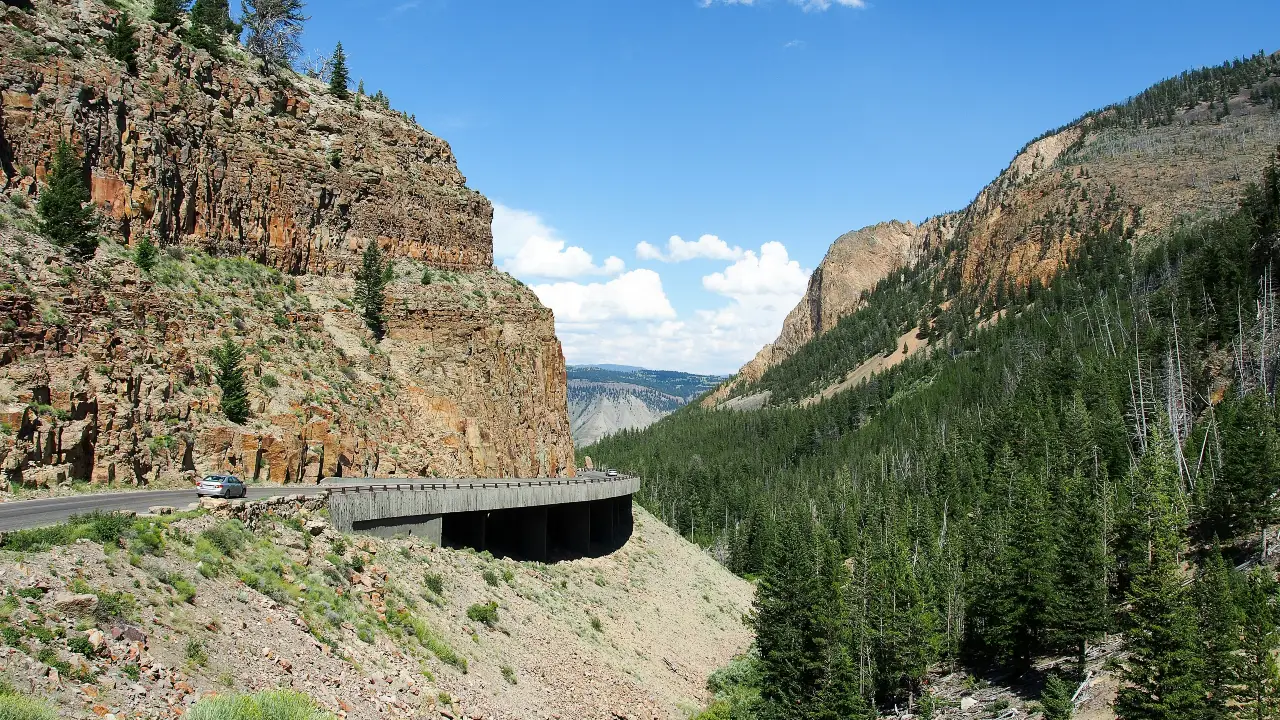
Many Yellowstone visitors focus on reaching the park as fast as possible. Beartooth Highway gives you a reason to slow down before you even reach the entrance.
A useful route starts in Red Lodge, Montana. From there, the road climbs into high alpine country before dropping toward Cooke City and Silver Gate near Yellowstone’s northeast entrance.
The road sits high enough that winter controls much of its schedule.
For 2026, Yellowstone listed the planned vehicle season for the Beartooth Highway from May 22 through October 12, weather permitting.
Route: Red Lodge to Beartooth Highway to Cooke City to Yellowstone northeast entrance
Allow: 1 to 2 days
Best for: Alpine views, mountain driving, Yellowstone access
Good stops: Red Lodge, mountain pullouts, Cooke City, Lamar Valley
2026 issue: Summer weather can still close the road
That last point deserves attention.
Montana transportation officials warn that high-elevation weather can cause temporary closures even during the normal open season.
So do not plan a trip that falls apart if Beartooth closes for a few hours.
Check MDT 511 before leaving Red Lodge. Check it again if the weather looks poor.
Bring a layer of warm clothing even when the lower towns are hot. Temperatures can feel very different at higher elevations.
This route also pairs well with Lamar Valley once you enter Yellowstone. That gives you a strong mix of mountain scenery and wildlife country without adding a long detour.
Montana DOT also posts seasonal road clearing updates and videos. Those are useful when you are traveling close to the start of the summer driving season.
The miles are not the hard part here. The weather is.
Give yourself time, keep the schedule flexible, and let the mountain conditions decide how fast you move.
7. Blue Ridge Parkway Is Better When You Stop Trying to Drive All 469 Miles
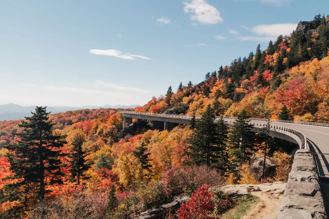
The Blue Ridge Parkway runs for 469 miles through Virginia and North Carolina.
That number can trick people into treating it like a road they need to finish.
You do not.
The National Park Service says driving about 30 miles can take around an hour because of lower speed limits, curves, overlooks, and stops.
The better plan is choosing one section and doing it well.
Route: Pick an open Virginia or North Carolina section based on current road status
Allow: 3 to 7 days
Best for: Green Mountains, overlooks, hiking, small mountain towns
Good bases: Shenandoah area, Blowing Rock area, Asheville area where access is open
2026 issue: Hurricane Helene repairs continue to affect sections
This is especially important in 2026.
Major repairs after Hurricane Helene continued along parts of the parkway. NPS listed some North Carolina sections under full closure, including stretches with repair schedules extending through late 2026.
Do not copy an old Blue Ridge Parkway itinerary and assume every mile is open.
Instead, open the National Park Service road status page before choosing your hotel.
If the Virginia section works better, build your trip there.
If you want the Blowing Rock or Linville area, check the exact mileposts that are open first.
If you are staying around Asheville, confirm both the parkway section and the access road you plan to use.
That small planning step can save hours.
The Blue Ridge Parkway is also a road where fewer miles often make a better day. Stop at overlooks. Take a short trail. Eat in a nearby mountain town.
You do not need to complete the entire parkway for the trip to feel complete.
8. Trail Ridge Road Takes You Above the Trees in Colorado
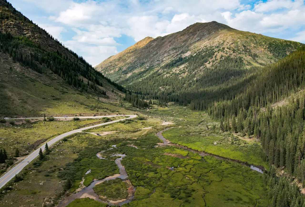
Trail Ridge Road gives you one of the easiest ways to reach true alpine country without leaving your car.
The 48-mile road crosses Rocky Mountain National Park between Estes Park and Grand Lake. It climbs to 12,183 feet, making it the highest continuous paved road in the United States.
Route: Estes Park to Alpine Visitor Center to Grand Lake
Allow: 1 to 2 days
Best for: Mountain views, wildlife, alpine scenery
Good stops: Many Parks Curve, Rainbow Curve, Alpine Visitor Center, Milner Pass, Grand Lake
2026 issue: Timed entry rules apply during peak hours
In 2026, visitors entering most of Rocky Mountain National Park between 9 a.m. and 2 p.m. need a timed entry reservation through October 12. You can enter before 9 a.m. or after 2 p.m. without that reservation, though a normal park entrance pass is still required.
Weather can change quickly at this elevation. Check the official road status before starting across the mountains.
9. North Cascades Highway Is Back After Major 2026 Repairs
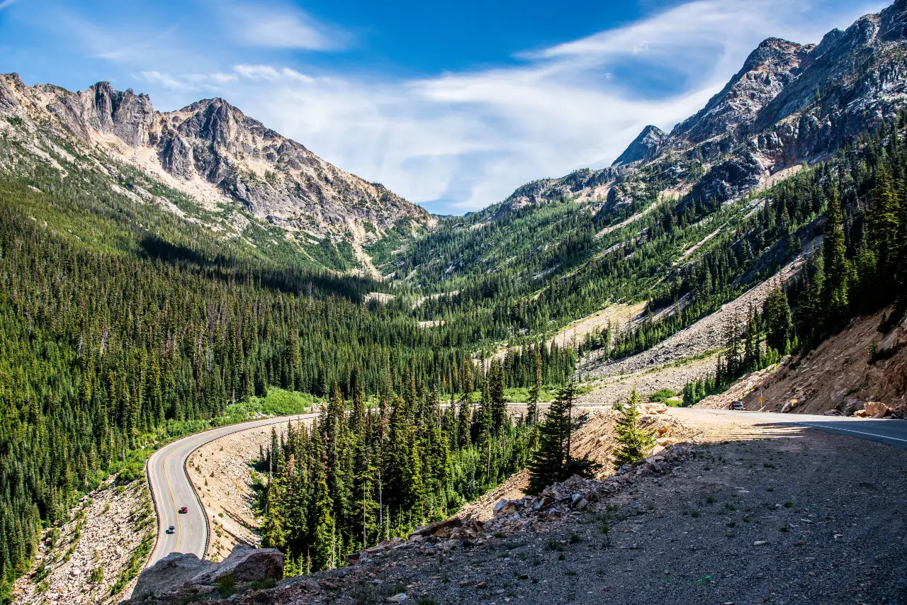
If you want sharp mountain peaks and blue lakes without following the usual national park route, put Washington’s North Cascades Highway on your list.
State Route 20 crosses northern Washington through some of the most dramatic scenery in the Cascades.
Route: Sedro Woolley to Diablo Lake to Washington Pass to Winthrop
Allow: 2 to 3 days
Best for: Mountain lakes, forests, hiking, small towns
Good stops: Diablo Lake, Ross Lake area, Washington Pass, Mazama, Winthrop
2026 issue: The highway required major emergency repairs
Winter damage and a rockslide near Diablo Lake caused major problems in 2026. Washington State DOT completed emergency work and fully reopened the North Cascades Highway on June 14.
That gives this route a strong 2026 reason to include it.
Do not assume it stays open because the calendar says summer. Check Washington road conditions before leaving, especially early or late in the season.
10. Oregon Coast Highway 101 Deserves More Than One Day
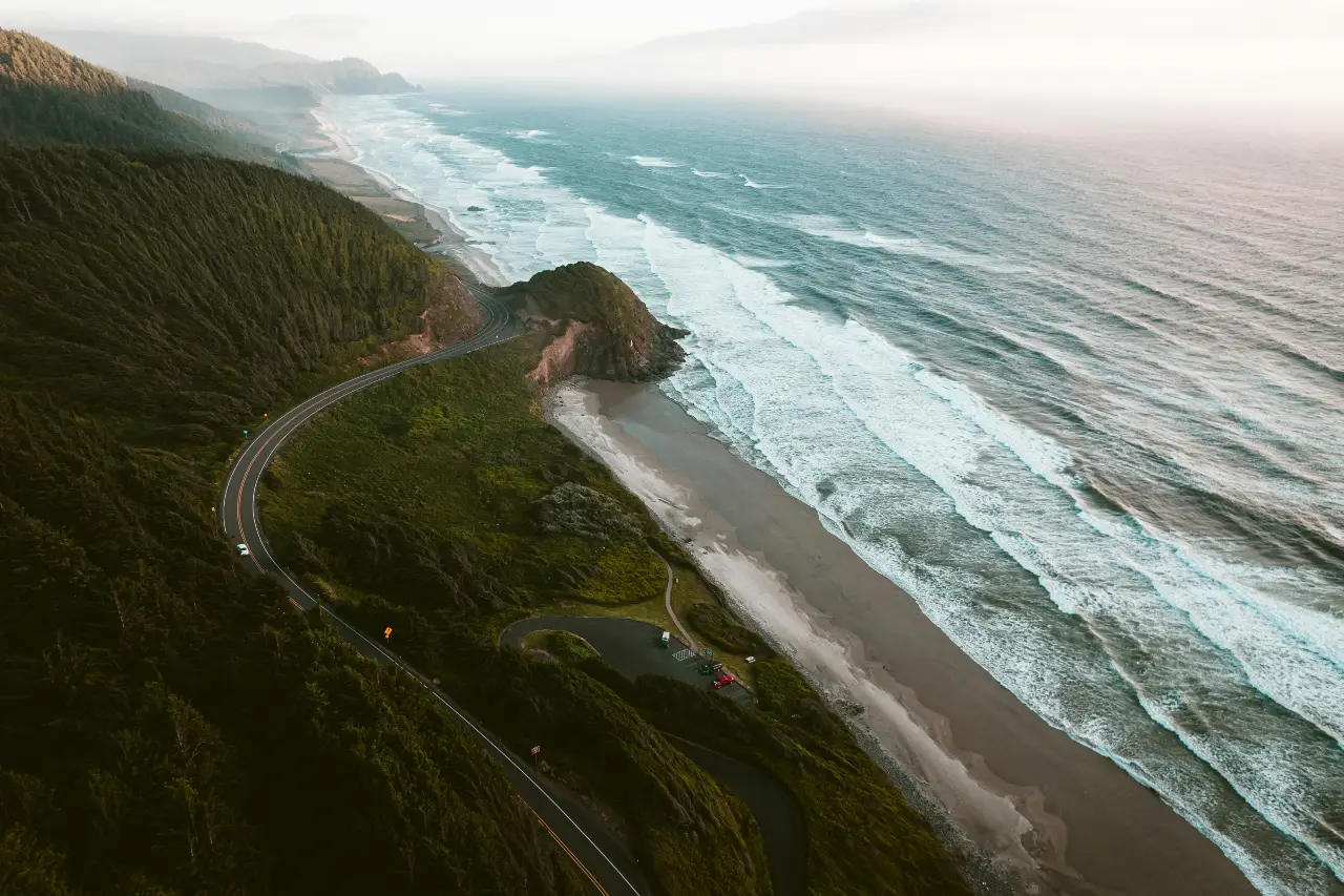
Oregon’s coast is perfect for travelers who want an ocean road trip without spending the whole day chasing mileage.
The Pacific Coast Scenic Byway follows 363 miles of coastline. Travel Oregon estimates about 10 to 12 hours of pure driving, which tells you why trying to finish it in a day makes little sense.
Route: Astoria to Cannon Beach to Newport to Bandon to Brookings
Allow: 5 to 7 days
Best for: Beaches, sea stacks, coastal towns, lighthouses
Good stops: Cannon Beach, Cape Perpetua area, Newport, Bandon, Samuel H. Boardman corridor
Summer issue: Fog and coastal weather can slow the drive
Break the trip into short driving days.
Two or three hours behind the wheel can easily become a full day once you add beaches, viewpoints, meals, and short hikes.
The southern Oregon coast also deserves extra time. Some of the most dramatic cliffs and sea stacks appear close to Brookings.
11. Seward Highway Packs Alaska Into 127 Miles
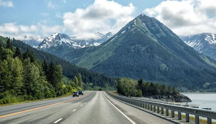
You do not need to drive across half of Alaska to get a great Alaska road trip.
The Seward Highway runs 127 miles between Anchorage and Seward. Its first 50 miles follow Turnagain Arm below the Chugach Mountains.
Route: Anchorage to Girdwood to Turnagain Pass to Seward
Allow: 2 to 4 days
Best for: Mountains, glaciers, wildlife, coastal scenery
Good stops: Turnagain Arm, Girdwood, Portage area, Summit Lake, Seward
Summer issue: Weather and road conditions can change quickly
Wildlife is another reason to slow down. Alaska DOT notes that travelers may see Dall sheep, eagles, waterfalls, and even beluga whales along parts of the road.
Stay overnight in Seward instead of driving back to Anchorage immediately.
That gives you time for the coast, nearby trails, and Kenai Fjords activities without turning the trip into one long day in the car.
12. San Juan Skyway Turns Colorado’s Mountains Into a 236 Mile Loop
This is the Colorado route to choose when you want mountain towns as much as mountain views.
The San Juan Skyway makes a 236-mile loop through southwest Colorado. Colorado DOT estimates about six hours of driving without long stops.
Route: Durango to Silverton to Ouray to Telluride to Cortez
Allow: 3 to 4 days
Best for: Historic towns, high mountain scenery, photography
Good stops: Durango, Silverton, Ouray, Telluride, Mesa Verde area
Summer issue: Mountain weather and road work can affect timing
The famous Million Dollar Highway between Silverton and Ouray is part of this loop.
Do not rush it.
Spend a night in at least one mountain town. That gives you time for viewpoints and short walks without turning every stop into a race back to the car.
Check Colorado road conditions before driving the high passes.
13. Kancamagus Highway Is Better Than Just a Fall Foliage Drive
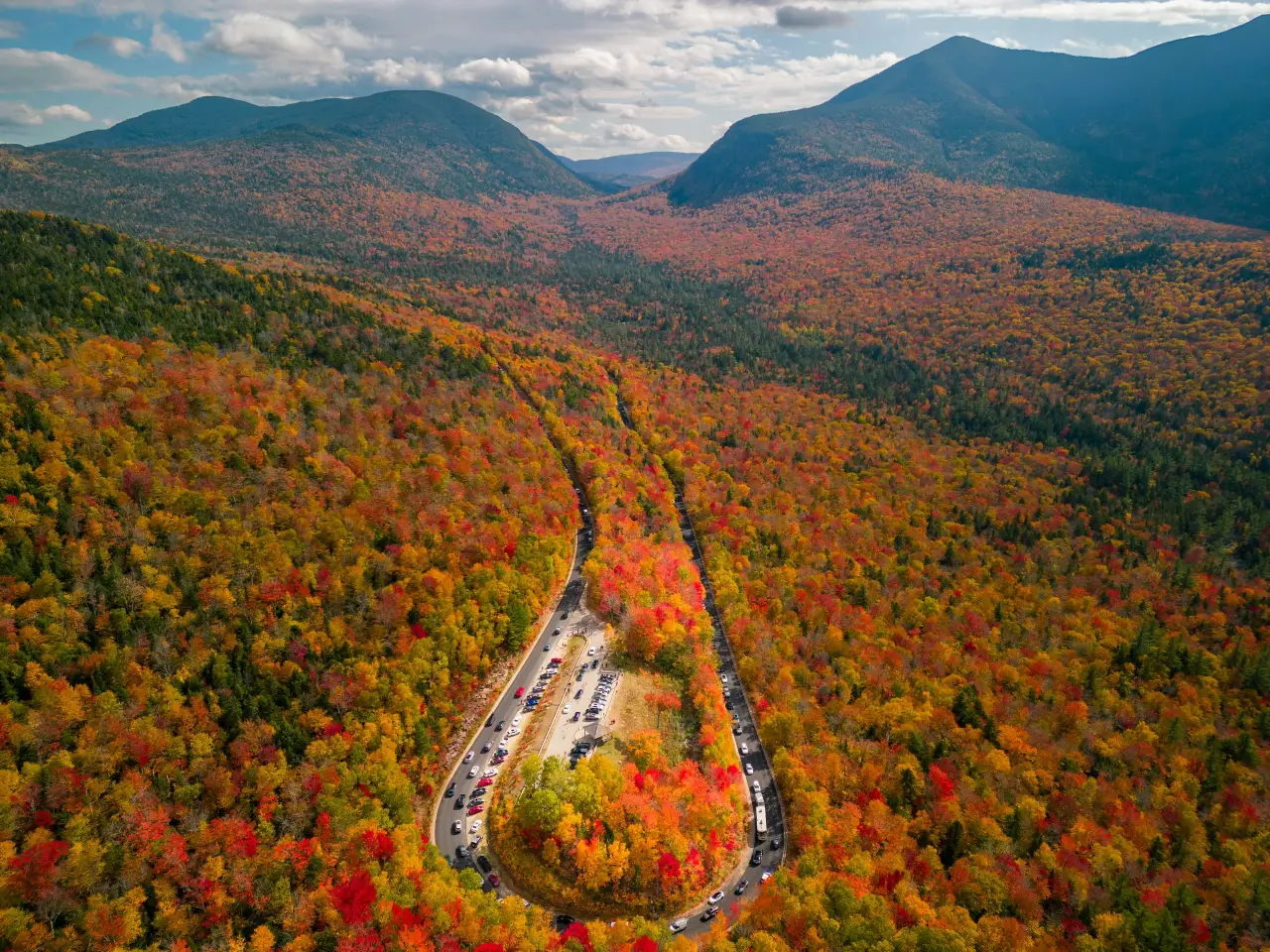
The Kancamagus Highway gets famous in fall. Summer may actually be easier if you want to stop and explore.
The road covers about 34.5 miles through New Hampshire’s White Mountain National Forest.
Route: Lincoln to Kancamagus Pass to Conway
Allow: 1 to 2 days
Best for: Forests, waterfalls, river stops, short hikes
Good stops: Scenic overlooks, Sabbaday Falls area, Swift River stops, Conway
Summer issue: Popular recreation areas can become busy
Do not judge this road by its short mileage.
A 35-mile drive can easily fill most of a day when you add overlooks, waterfalls, swimming spots, and forest walks.
You can also turn it into a much larger White Mountains loop through Franconia Notch and Crawford Notch. New Hampshire tourism suggests a roughly 142-mile version using several scenic roads.
14. Natchez Trace Parkway Lets You Slow Down for 444 Miles
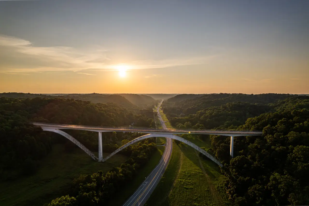
This route feels very different from the mountain drives on the list.
The Natchez Trace Parkway stretches 444 miles between Natchez, Mississippi, and an area just south of Nashville. NPS recommends about three days for a basic end-to-end trip and five days if you want more time at the stops.
Route: Natchez to Jackson area to Tupelo to Nashville area
Allow: 3 to 5 days
Best for: History, quiet roads, easy walks, slower travel
Good stops: Natchez, historic Trace sites, Tupelo area, Meriwether Lewis area
2026 issue: A northern section is closed for bridge construction
A section around mileposts 437 to 440 is closed from April 2026 through May 2027 for work on the Double Arch Bridge.
There are also no food, fuel, or lodging businesses directly on the Parkway. Those services are found in nearby communities, so plan fuel stops before you need them.
15. Overseas Highway Lets You Drive From Island to Island
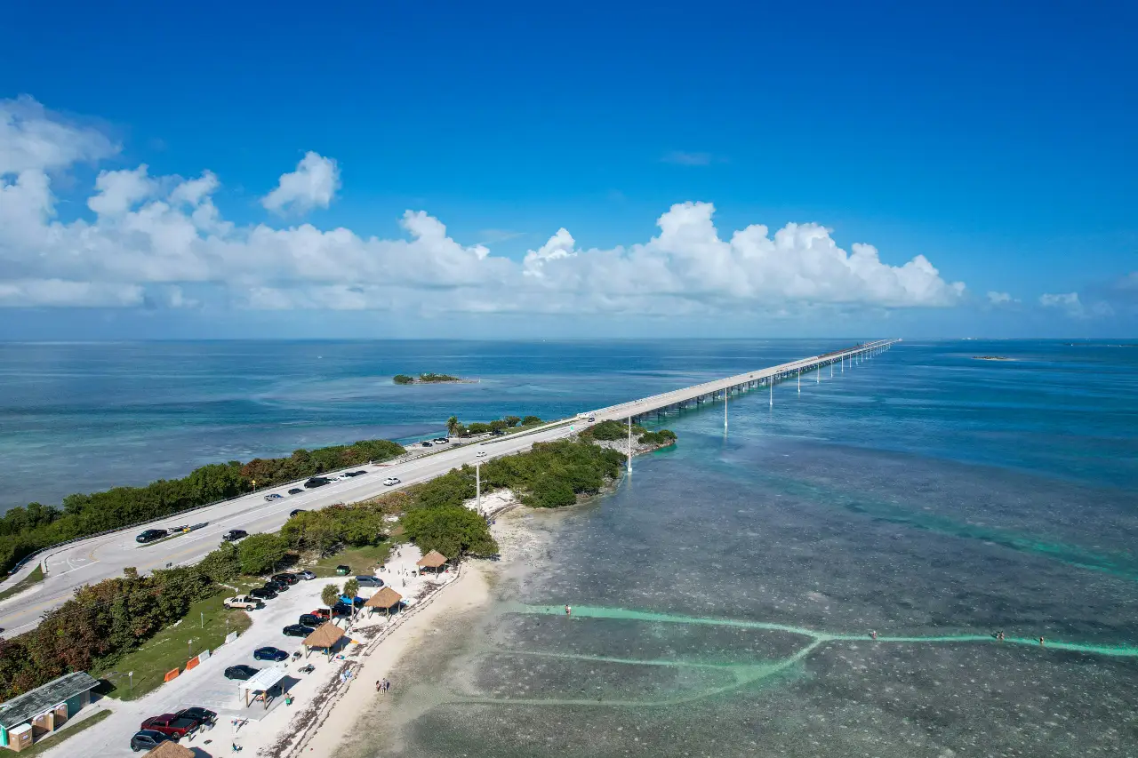
Few American road trips feel as different from the mainland as the Overseas Highway.
The Florida Keys Scenic Highway runs about 106 miles from Key Largo to Key West. It is Florida’s only federally designated All-American Road.
Route: Key Largo to Islamorada to Marathon to Key West
Allow: 3 to 5 days
Best for: Ocean views, islands, seafood, water activities
Good stops: Key Largo, Islamorada, Marathon, Bahia Honda, Key West
Summer issue: Heat and tropical weather
Do not make Key West the only goal.
Spend a night farther north in the Keys. That gives you time to stop for beaches, food, snorkeling, and the bridges instead of watching the clock all day.
Summer also means you should check tropical weather every morning. A storm can change road and water plans quickly.
16. Sawtooth Scenic Byway Shows You a Quieter Side of Idaho
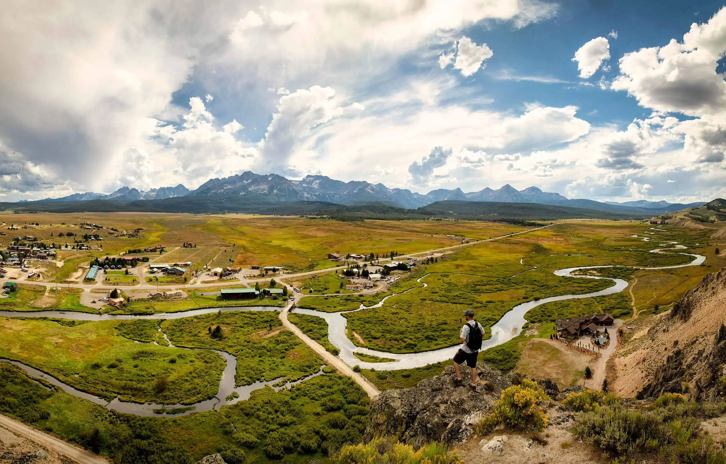
Idaho’s Sawtooth Scenic Byway moves from open high desert into some of the sharpest mountain scenery in the state.
The official tourism route runs 116 miles from Shoshone to Stanley along Idaho 75.
Route: Shoshone to Ketchum to Galena Summit to Stanley
Allow: 2 to 3 days
Best for: Mountain lakes, small towns, hiking, stargazing
Good stops: Sun Valley, Ketchum, Galena Summit, Redfish Lake, Stanley
Summer issue: Long stretches deserve fuel and weather planning
The route itself can be driven in a few hours. Do not do that.
Spend one night around Ketchum or Sun Valley and another around Stanley.
Redfish Lake alone is worth several hours. The region also sits close to some excellent dark sky areas.
Idaho tourism lists fuel, food, and lodging in Shoshone, Hailey, Ketchum, Sun Valley, and Stanley, which makes those towns useful anchors for the trip.
17. Chief Joseph Scenic Byway Gives Yellowstone Travelers Another Way In
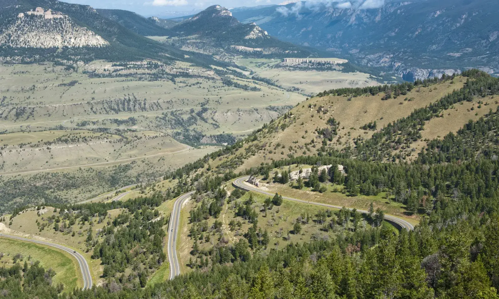
If Beartooth Highway is already in your article, Chief Joseph Scenic Byway makes a natural companion route.
Wyoming designated the 47-mile WYO 296 corridor as the Chief Joseph Scenic Highway. It crosses the Absaroka Mountains and offers access to the country northeast of Yellowstone.
Route: Cody area to Chief Joseph Highway to the Beartooth junction
Allow: 1 full day
Best for: Wildlife, mountain views, history, Yellowstone extensions
Good stops: Sunlight Basin, mountain overlooks, Dead Indian Summit area
Summer issue: Check mountain weather before committing to the full route
The best way to use it is as part of a larger loop.
Start around Cody, cross Chief Joseph Scenic Byway, connect with Beartooth Highway, and continue toward Cooke City if conditions allow.
That gives readers another Yellowstone road trip without simply repeating the standard western entrance.
Which Summer Road Trip Fits the Trip You Actually Want?
A great road trip is not always the most famous one. It is the one that matches how much time you have and what you want to see.
Use this quick guide before booking hotels.
| If you want | Consider |
|---|---|
| Ocean and cliffs | Big Sur Highway 1 |
| Huge mountain scenery | Going to the Sun Road |
| Red rock and desert | Scenic Byway 12 |
| Rainforest and beaches | Olympic Peninsula |
| Sierra lakes and granite | Tioga Road |
| High alpine driving | Beartooth Highway |
| Green mountains and small towns | Blue Ridge Parkway |
Big Sur works well when you only have a few days and want dramatic scenery without a long route.
Olympic Peninsula is better if you have four or five days and want several types of landscapes.
Highway 12 gives you one of the strongest choices for a Southwest road trip. You can also connect it with national park stops.
Glacier and Beartooth require more respect for mountain weather. Their summer access can be shorter and less predictable than lower roads.
Think about driving comfort too. Steep drop-offs and mountain curves are part of several routes on this list.
If heights make you nervous, study the road before choosing it.
Your perfect trip should fit you. You should not spend three days stressed because a famous route looked good in a photo.
Make These 10 Checks Before You Leave Home
Beautiful scenery does not help much when the road is closed or your car will not start.
Spend ten minutes checking the basics before every long driving day.
- Check the state transportation department road map.
- Check National Park Service alerts where your route crosses federal land.
- Look for wildfire or smoke warnings.
- Read the local weather forecast.
- Confirm current park entry rules.
- Check where you can buy fuel.
- Confirm your hotel or campground reservation.
- Check vehicle size rules if you drive an RV, trailer, or large van.
- Save maps to your phone for offline use.
- Carry drinking water and basic emergency supplies.
This sounds simple because it is simple. But these checks solve many of the problems that turn a good trip into a stressful one.
Mountain roads deserve extra attention. A sunny forecast in the town below does not always tell you what conditions will be like at a high pass.
The same goes for wildfire country. Smoke and temporary road closures can change quickly.
Do another quick check each morning. It takes a few minutes and can save half a day.
Save the Route, But Leave Room to Change It
These seven US road trips give you very different versions of an American summer.
Big Sur brings the Pacific right beside the road. Glacier and Beartooth take you high into the mountains. Highway 12 gives you red rock. Olympic combines forest with wild coastline. Tioga Road crosses Yosemite’s high country, while the Blue Ridge Parkway slows everything down among the Appalachians.
But none of these routes should be planned too tightly.
Road work, snow, fires, weather, parking, and crowds can change the day.
Save the route you want now. Book the nights that are hard to replace. Then leave enough space in the schedule to stop when something better appears around the next bend.