Solo camping is exploding in popularity. 31% of campers now go solo at least once per year, a 63% increase since 2021. Poor campsite selection is killing people. Falls account for 50% of all hiking injuries, and environmental factors cause most camping fatalities.
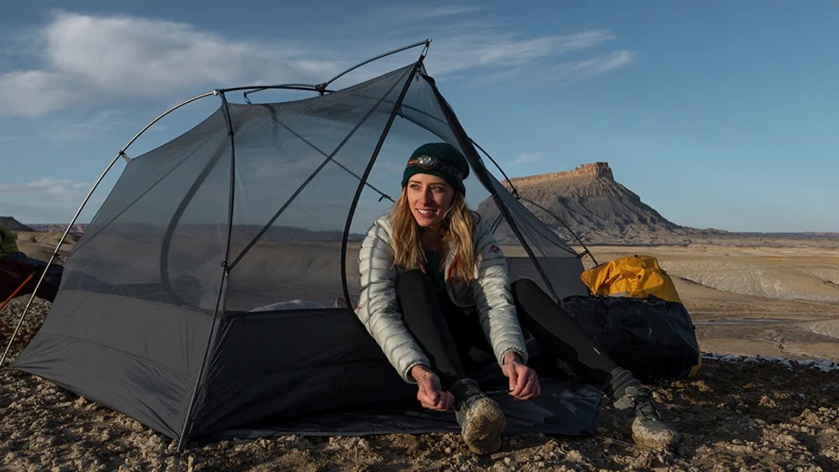
The difference between a great solo camping trip and a disaster often comes down to the 10 minutes you spend choosing where to pitch your tent. Most solo campers focus on finding level ground and a nice view. They miss the subtle warning signs that separate safe campsites from death traps.
Dead trees that could fall on your tent. Flash flood zones that look perfectly safe until water rises 10 feet in an hour. Wildlife signs that mean you’re camping in a predator’s dinner room.
21 Warning Signs You Picked The Wrong Solo Camping Spot
Environmental Hazards That Scream Danger
Every year, falling trees and branches cause multiple campsite fatalities. Lightning strikes kill about 27 people annually during outdoor activities. Flash floods can rise 10 feet in under an hour, even from storms miles away.
i. Dead Trees Are Silent Killers

Campers call them “widow makers” for good reason. Dead trees and large branches fall without warning, especially during wind or storms.
The 1.5x tree height rule saves lives. If a dead tree is 60 feet tall, stay at least 90 feet away from it. Look up before you set up camp. Check for:
i. Trees with no leaves during the growing season
ii. Bark falling off in large chunks
iii. Mushrooms growing on the trunk
iv. Leaning trees over 15 degrees
v. Large dead branches hanging overhead
The National Park Service warns that even healthy-looking trees can have hidden rot or damage that makes them unstable. Wind speeds as low as 39 mph can bring down damaged trees.
ii. Flash Flood Zones Hide In Plain Sight

Water can rise from ankle-deep to over your head in minutes. Flash floods happen even when it’s sunny at your campsite if storms hit upstream. Never camp in these death traps:
i. Dry creek beds or washes (water follows these paths)
ii. Areas with debris lines on rocks or trees
iii. Low spots between hills where water flows
iv. Within 200 feet of any water source during storm season
Look for high-water marks on rocks and trees. These brown or gray lines show how high the water has risen before. If you see trash, logs, or sand in weird places, water put them there.
The 200-foot rule isn’t just about water access. Leave No Trace principles require this distance to protect water sources, but it also keeps you safe from sudden flooding.
iii. Rockfall Zones Are Everywhere In The Mountains

Loose rock kills more climbers and campers than bears ever will. Rockfall happens day and night, with no warning sounds. Spot the danger signs:
Fresh rock chips or dust at the base of cliffs
i. Loose stones that move when you touch them
ii. Cracks in rock faces above your head
iii. Scree slopes (loose rock piles) nearby
Don’t camp directly below any cliff face, even small ones. Rocks can bounce unpredictably and travel much farther than you think. Set up camp at least 100 feet away from cliff bases.
iv. Lightning Turns High Ground Into Death Zones

Lightning seeks the highest point in an area. If you’re on a ridge, hill, or open field, you become the highest point. Get off these lightning magnets immediately:
i. Ridge lines and mountain peaks
ii. Open meadows with no trees
iii. Lone trees in fields
iv. Metal structures or fences
v. Bodies of water
The National Park Service says to camp in low areas with uniform tree cover. Trees should be about the same height around you, creating a natural lightning rod system away from your tent.
If you hear thunder, you’re already in danger. Lightning can strike up to 10 miles from a storm.
Wildlife Warning Signs Every Solo Camper Ignores
You wake up to find giant paw prints circling your tent. Your heart pounds as you realize a bear visited while you slept. This happens because you missed the warning signs.
Wildlife kills only 10 people in all National Parks from 2007-2024. But encounters cause injuries, destroyed gear, and dangerous situations that force expensive rescues. Here’s how to read the animal signs that most solo campers walk right past.
i. Fresh Bear Sign Means Danger Now

Bears leave obvious clues when they’re active in an area. A fresh sign means a bear was there within the last 24-48 hours. Look for these red flags:
i. Scat (poop) that’s still soft or steaming. Fresh bear scat looks like large dog poop but contains berries, seeds, or fur.
ii. Tracks in mud or soft dirt. Bear prints show five toes and claws. Front paws are 5-7 inches long.
iii. Claw marks on trees. Fresh scratches show light-colored wood underneath dark bark.
iv. Rolled logs and torn-apart stumps. Bears flip logs looking for insects.
v. Bent or broken bushes. Bears push through vegetation, leaving a clear path.
Don’t camp anywhere you find fresh bear sign. Move at least half a mile away.
ii. Game Trails Are Wildlife Highways

Animals use the same paths every day to reach water, food, and shelter. These trails cut through thick vegetation and follow the easiest route. Spot these animal highways:
i. Worn dirt paths through grass or woods
ii. Branches broken at consistent heights (showing animal size)
iii. Trampled vegetation in straight lines
iv. Multiple sets of tracks in the same area
Game trails often lead to water sources where animals gather most at dawn and dusk. Set up camp well away from these wildlife meeting spots.
iii. Territorial Behavior Warns You to Leave

Some animals defend specific areas aggressively, especially during mating season or when protecting young. Watch for these aggression signals:
i. Birds dive-bombing or making alarm calls. This means predators or threats are nearby
ii. Squirrels chattering loudly and consistently. They’re warning other animals about danger
iii. Fresh scratching posts or scent marking. Animals mark territory boundaries with urine, scat, or claw marks
If animals seem agitated or are making lots of noise, something has them stressed. That something might be you, or it might be a larger predator.
iii. Timing Matters For Wildlife Safety

Most dangerous wildlife encounters happen during specific times when animals are most active. High-risk times for encounters:
i. Dawn and dusk. Most animals feed during these hours
ii. Middle of the night. Nocturnal predators are hunting
iii. Early spring. Animals are hungry after winter, and protecting newborns
iv. Late fall. Animals are building fat reserves before winter
iv. Regional Differences Change The Rules

Western US dangers: Grizzly bears, mountain lions, elk, and moose. These animals are larger and more aggressive than eastern wildlife.
Eastern US dangers: Black bears, venomous snakes, and wild boar in some areas. Black bears are smaller but still dangerous when surprised.
Mountain lions live in both regions, but are more common in the west. They leave round tracks with no claw marks and prefer areas with lots of deer.
Your action plan: If you see fresh wildlife sign, don’t try to be tough. Move your campsite immediately. The 10-minute walk to a safer spot beats a hospital stay or rescue bill.
Weather Patterns That Turn Campsites Deadly
The weather forecast said “partly cloudy.” Now you’re watching lightning strike the ridge where you almost set up camp. Weather kills more campers than bears, snakes, and mountain lions combined.
Flash floods can rise over 10 feet in under an hour, even from storms happening miles away. Lightning strikes without warning. Temperature drops can cause hypothermia in July. Here’s how to read the weather signs that separate safe campers from rescue statistics.
i. Flash Flood Zones Hide Everywhere

Water doesn’t care about your campsite plans. It follows the path of least resistance, which means low spots become death traps fast. Never camp in these flood zones:
i. Dry creek beds or washes. These fill first when rain hits upstream
ii. Areas with debris lines on rocks. Those brown marks show how high the water reached before
iii. Low spots between hills. Water collects here from multiple directions
iv. Anywhere you see sand, logs, or trash in strange places. Water carried them there
Look at the ground around potential campsites. If you see rounded rocks, smooth sand, or vegetation bent all in one direction, water flows through there regularly.
ii. Storm Warnings Most People Miss

Storms move fast in the mountains and can appear from nowhere. Your phone’s weather app might not show local conditions accurately. Watch for these danger signs:
i. Towering clouds are building in the afternoon. These turn into thunderstorms within hours
ii. Temperature dropping suddenly. Cold air means a front is moving in
iii. Wind shifting directions. This signals that weather changes are coming fast
iv. Animals acting nervously. Birds stop singing, squirrels hide, insects disappear
The National Park Service says if you can hear thunder, you’re already in the lightning danger zone. Lightning can strike up to 10 miles from a storm.
iii. Wind Turns Campsites Into Danger Zones

Strong winds don’t just make sleeping uncomfortable. They knock down trees, tear apart tents, and create deadly flying debris. Avoid these wind exposure mistakes:
i. Camping on ridgelines where the wind accelerates
ii. Setting up in valleys that funnel wind between peaks
iii. Pitching tents under trees that sway in light breezes
iv. Choosing exposed meadows with no natural wind breaks
Look for areas protected by rock formations or dense trees. But make sure those trees aren’t dead or leaning.
iv. Temperature Drops Kill In Summer

Mountain weather can drop 20-40 degrees after sunset. What feels warm at 2 PM can cause hypothermia by midnight. Altitude changes everything:
i. The temperature drops 3-5 degrees for every 1,000 feet higher you go
ii. Clear skies mean bigger temperature swings
iii. Wind makes the cold feel much worse
v. Technology That Saves Lives

Your phone can predict the weather better than you can read clouds. Essential weather apps for 2025:
i. Weather Underground. Shows hyperlocal conditions and radar
ii. Dark Sky (now Apple Weather). Gives minute-by-minute precipitation predictions
iii. NOAA Weather Radar. Shows real storm movement and intensity
iv. Windy.com. Best for wind speed and direction forecasting
Check the weather every few hours, not just once before you leave home. Mountain weather changes fast, and afternoon storms are common even on clear mornings.
Your weather action plan: If any storm signs appear, start breaking camp immediately. It’s easier to set up again later than to survive a flash flood or lightning strike.
Terrain Mistakes That Trap Solo Campers
You’re setting up camp on what looks like solid ground. Then you step near the edge and watch a chunk of rock tumble 200 feet down the cliff. Bad terrain choices trap solo campers in deadly situations every year.
One wrong step can send you falling. Unstable ground can collapse under your tent. Rockslides can bury your campsite while you sleep. Here’s how to read terrain like your life depends on it – because it does.
i. Cliff Edges Are Death Traps In Disguise

Cliffs kill through falls, but also through erosion that happens without warning. Rock edges that look solid can crumble under your weight. Stay away from these cliff danger signs:
i. Loose rocks or gravel near edges. This shows active erosion
ii. Cracks running parallel to cliff faces. These sections can break off suddenly
iii. Overhanging ledges. They look cool, but can collapse
iv. Areas where water runs off the edge. Water weakens rock over time
The National Park Service says to stay at least 20 feet back from any cliff edge. Wind can be stronger near cliffs and can blow you off balance.
ii. Unstable Ground Hides Everywhere

Not all dangerous ground looks dangerous. Some terrain seems solid until you put weight on it. Test the ground before camping:
i. Stomp hard with your boots. Hollow sounds mean space below
ii. Look for sinkholes or depressions. These show where the ground has already collapsed
iii. Check for soft, spongy areas. This could be boggy ground that won’t support weight
iv. Avoid areas with lots of loose rocks. These can shift and roll
If your tent stakes won’t hold or keep pulling out, the ground is telling you something. Find more solid terrain.
iii. Rockfall Zones Are Invisible Killers

Falling rocks kill climbers and campers regularly. Most people never see rockfall zones until it’s too late. Spot these rockfall warning signs:
i. Fresh rock chips at the base of cliffs
ii. Scree slopes (loose rock piles) above your campsite
iii. Recent scars on rock faces show where chunks fell off
iv. Rocks that move when you touch them
Never camp directly below cliff faces, even small ones. Rocks bounce unpredictably and can travel much farther than you think.
iv. Plan Your Escape Before You Need It

Solo campers need two ways out of every campsite. If rockfall blocks one route, you need a backup plan. Your escape route checklist:
i. Can you reach your car or main trail in the dark?
ii. Is there a second way out if the first gets blocked?
iii. Can you carry your gear quickly if you need to move fast?
Bad terrain doesn’t announce itself. It waits until you’re committed, then shows its true nature.
Water Hazards Hiding In Plain Sight
That crystal-clear mountain stream looks perfect for camp. But hidden 50 yards upstream, a dead deer is rotting in the water. Water kills more campers than you think.
Drowning accounts for 33% of all National Park fatalities. But water dangers go beyond drowning; contaminated water causes severe illness, and cold water shock can kill within minutes. Here’s how to spot water hazards before they make you sick or worse.
i. Contamination Signs Most Campers Miss

Water can look clean but still carry deadly bacteria, parasites, or chemicals. Never drink from water with these warning signs:
i. Dead animals or fish floating nearby. They release bacteria and toxins
ii. Green or blue-green algae blooms. These produce dangerous toxins
iii. Strong chemical or rotten egg smells. This indicates pollution or sulfur
iv. Foam or oil slicks on the surface. Signs of chemical contamination
v. Cattle or wildlife scat within 100 yards. Animal waste carries E. coli and parasites
Even water that passes these tests needs treatment. All natural water sources can carry Giardia, cryptosporidium, and other microscopic threats.
ii. Dangerous Currents Hide Underwater

Moving water is stronger than it looks. Currents that seem gentle can knock you down or sweep you away. Avoid these current danger zones:
i. Areas where water flows between rocks or logs
ii. Deep pools with swirling or churning water
iii. Spots where fast water meets slow water
iv. Any water moving faster than walking speed
The National Weather Service warns that water only 6 inches deep can knock you over if it’s moving fast enough.
iii. Cold Water Shock Kills In Minutes

Mountain water stays cold even in summer. Water below 70°F can cause hypothermia. Water below 60°F can kill through cold water shock. Cold water shock happens in four stages:
i. You can’t breathe for 1-3 minutes
ii. You lose control of your arms and legs
iii. Hypothermia sets in after 30 minutes
iv. You go unconscious and drown
iv. Keep A Safe Distance From Water

REI experts recommend camping at least 200 feet from water sources. This distance protects water quality and keeps you safe from flash floods.
Your water safety action plan: Always treat water before drinking, even if it looks clean. Stay out of moving water. Camp far enough away that rising water can’t reach your tent.
Water hazards hide behind beautiful scenery. Don’t let a pretty stream become your last campsite mistake.
Technology That Could Save Your Life
You’re hurt, alone, and your phone shows “No Service.” The sun is setting, and nobody knows where you are. This is when the right technology means the difference between rescue and becoming a statistic.
Search and rescue teams conduct thousands of missions every year to find lost or injured solo campers. Many of these emergencies could be prevented or resolved faster with the right tech. Here’s the life-saving technology you need for 2025.
i. Essential Safety Apps That Work Offline

Your phone is useless without a signal, but these apps work even when you’re completely offline.
What3words. This free app gives every 10-foot square on Earth a unique three-word address. Instead of trying to describe your location, you just give rescuers three words like “slept, ramp, hunter.” Emergency services in the US, Canada, and the UK use what3words to find people faster.
AllTrails Pro ($30/year). Downloads detailed maps to your phone that work without cell service. Shows your exact location even offline and lets you share your route with emergency contacts.
Gaia GPS ($40/year). Professional-grade mapping that includes topographic maps, weather layers, and offline navigation. Search and rescue teams use this same technology.
ii. Satellite Communicators Save Lives Beyond Cell Towers

When your phone can’t reach help, satellite devices can reach anywhere on Earth.
Budget option: Garmin inReach Mini 2 ($400 + $15/month). Sends SOS signals and text messages via satellite. Weighs only 3.5 ounces, and the battery lasts up to 14 days.
Premium choice: Garmin inReach Explorer 2 ($450 + $15/month). Includes GPS navigation, weather updates, and two-way messaging. Has a built-in compass and can share your location automatically.
These devices connect to the same satellite network that handles aircraft emergencies. When you hit the SOS button, it goes directly to professional rescue coordination centers.
iii. Emergency Location Sharing That Actually Works

iPhone Emergency SOS via satellite (iPhone 14 and newer), Free for first two years, then $5/month. Works without cell service to contact emergency services and share your location.
Google’s Emergency Location Service – Automatically shares your precise location when you call emergency services, even if GPS is off.
Legal And Regulatory Red Flags
You wake up to a ranger writing you a $500 ticket for camping in a restricted area. The sign was 50 yards away, but you didn’t see it in the dark. Legal camping mistakes can cost you thousands of dollars and create permanent criminal records.
Camping violations aren’t just expensive tickets. They can void your insurance, create liability issues, and even result in jail time in some areas. Here’s how to spot the legal red flags that turn camping trips into court dates.
i. Restricted Areas Hide Everywhere

Federal, state, and private lands all have areas where camping is completely banned. These restrictions change without warning. Look for these restriction signs:
i. “No Camping” or “Day Use Only” signs. Often small and easy to miss
ii. Wilderness area boundaries. Many require permits and have camping restrictions
iii. Private property markers. Purple paint on trees in some states means “No Trespassing”
iv. Wildlife closure signs. Areas closed to protect nesting birds or migrating animals
The National Park Service warns that “I didn’t see the sign” isn’t a legal defense. Rangers expect you to research restrictions before you camp.
ii. Permit Violations Cost Serious Money

More areas require permits now than ever before. Some popular camping spots need reservations months in advance. Common permit mistakes:
i. Camping in permit areas without proper paperwork
ii. Staying longer than your permit allows
iii. Camping with more people than your permit covers
iv. Using permits in the wrong locations or wrong dates
Fines range from $100 to $5,000, depending on the area and violation.
iii. 2025 BLM Changes Affect Millions Of Acres

The Bureau of Land Management updated dispersed camping rules in 2025. Many areas that allowed free camping now require permits or have moved to reservation systems.
Check the BLM website before camping on any public land. Rules change monthly in popular areas.
The Immediate Action Plan When You Spot Danger
You just spotted fresh bear tracks around your tent. Your heart is racing and you’re not sure what to do next. This is when panic kills solo campers faster than the actual danger.
Search and rescue experts have protocols for exactly this situation. When you spot any of the 21 warning signs, don’t panic. Follow this step-by-step action plan instead.
i. Use the Sar Expert STOP Protocol

Search and rescue teams train people to use STOP when they realize they’re in danger:
S – STOP what you’re doing immediately. Don’t set up more gear or try to “make it work.”
T – THINK about what you observed. Fresh bear sign? Storm clouds? Unstable ground?
O – OBSERVE your surroundings again. Look for escape routes and immediate threats you missed.
P – PLAN your next move before you act.
This protocol prevents the rushed decisions that turn small problems into emergencies.
ii. Plan your escape before you need it

Identify two ways out of your current location:
i. Your primary route back to your car or main trail
ii. A backup route in case the first gets blocked
Pack essentials first: Water, food, warm clothes, and emergency gear. Leave camp luxuries behind if you need to move fast.
Mark your location: Use the what3words app to get your three-word address. Screenshot this and your GPS coordinates.
iii. Emergency communication steps

If you have cell service:
i. Text your location (including what3words address) to emergency contacts
ii. Call 911 if you’re in immediate danger
iii. Stay on the line and follow the dispatcher’s instructions
If you have no cell service:
i. Activate your satellite communicator SOS
ii. Move to higher ground for a better signal if safely possible
iii. Create visible signals (bright colors, reflective items) for rescuers
FAQs
What should I do if I have already pitched my tent and then spot warning signs?
Pack up immediately and move, even if it’s getting dark. Don’t try to “tough it out” for one night. Most camping accidents happen to people who notice warning signs but decide to stay anyway. Keep a headlamp handy so you can pack safely in the dark if needed.
How far do I need to move to be safe from warning signs?
The distance depends on the specific danger bear sign; move at least half a mile away. Dead trees or rockfall zones stay 100+ feet away from the hazard. Flash flood areas get to higher ground at least 50 feet above the water level. Lightning exposure. Move to low ground with uniform tree cover
Which warning sign requires immediate evacuation?
Rising water is the most deadly warning sign. Flash floods kill more campers than any other hazard because they happen so fast. Other signs that require immediate evacuation include fresh, large predator tracks around your tent, rocks actively falling, and lightning strikes nearby.
How can I tell if a bear’s sign is fresh enough to be dangerous?
Fresh bear poop is soft, moist, or steaming. Old scat is dry and crumbly. Fresh tracks have sharp edges in mud or soft dirt. Rain hasn’t washed them away. Fresh scratches on trees show light wood underneath the bark. Old marks are weathered and gray.