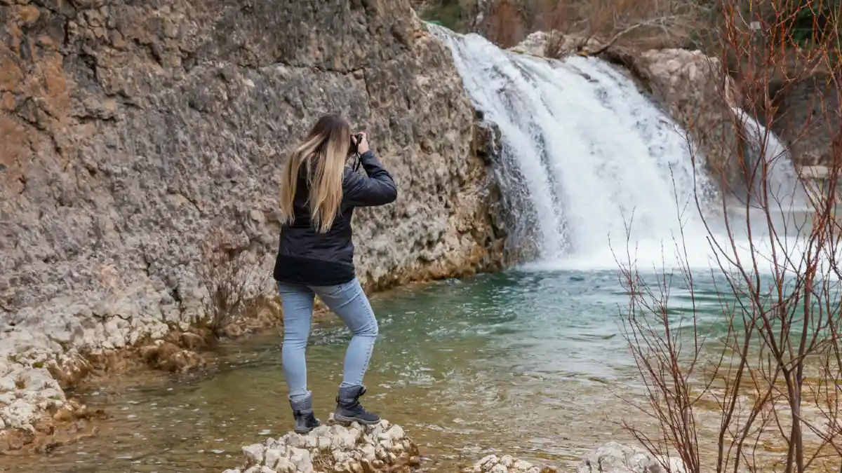
You know the feeling. You drive hours to see a “hidden” waterfall, only to find packed parking and crowds taking selfies. The magic is gone.
California generates $157.3 billion from 264 million tourists annually. Yet these 9 waterfalls remain virtually unknown: Jackson Falls, Foresta Falls, Waterwheel Falls, Chilnualna Falls, Stoddard Canyon Falls, Pfeiffer Falls, Nojoqui Falls, Faery Falls, and Tenaja Falls.
Each location is genuinely off the beaten path. No recycled blog content here. But social media ruins hidden places fast. McWay Falls and Alamere Falls prove this pattern.
Visit these responsibly now, or watch them become restricted later. Your choice determines their future.
1. Jackson Falls – Yosemite’s Best Kept Swimming Secret
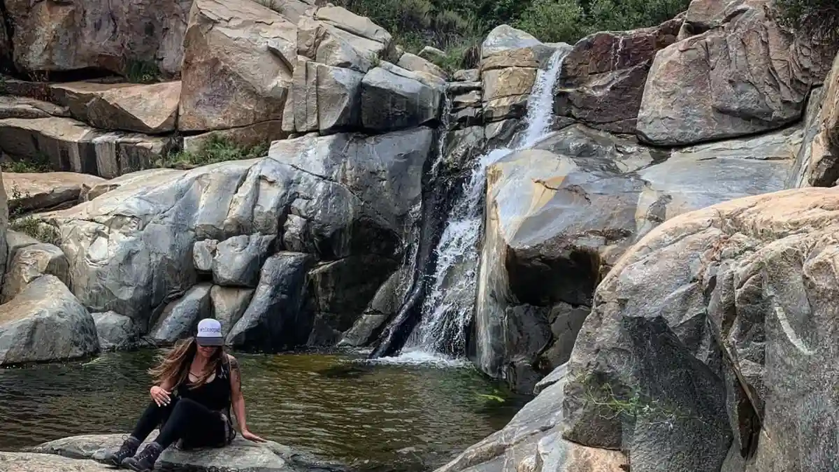
You’re tired of crowded swimming holes where you can’t even find a spot to put your towel down. Jackson Falls solves that problem.
Location: Fish Camp, Sierra National Forest
This waterfall sits just outside Yosemite’s south entrance in Fish Camp. It’s technically in Sierra National Forest, not the park itself. That means no entrance fees and way fewer people.
Why It’s Hidden: The Trailhead Tricks Most People
Here’s the truth: Finding Jackson Falls isn’t easy. There’s no big sign pointing the way. The parking situation confuses most visitors. They give up and drive to easier spots.
The trailhead looks more like a random pullout than a hiking spot. Most people drive right past it. Even when they stop, they can’t figure out where to park legally.
That’s exactly why this place stays empty. The hard-to-find access keeps away casual visitors. Only people who do their homework make it here.
Access Details: 2.5 Miles to Three Perfect Swimming Spots
The hike is 2.5 miles round-trip. Not too long, but not a quick walk either. You’ll work for this reward.
The trail follows an old logging road for the first mile. Easy walking through pine forest. Then you drop down to follow the creek bed. This part gets more interesting.
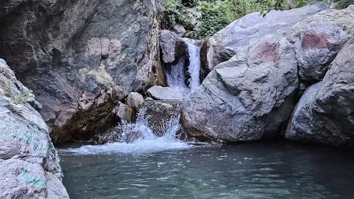
Three granite pools wait at the end. Each one is perfect for swimming. The water stays cold all year thanks to snowmelt from higher up.
The first pool is biggest and deepest. Great for jumping if you test the depth first. The second pool stays warmer in summer. The third pool is smallest but most private.
Best Time: March Through November
March brings the strongest water flow as snow melts. The falls roar and the pools fill up fast. But the water is freezing.
Summer months offer the best swimming. The water warms up enough that you won’t go numb instantly. July and August are perfect for families with kids.
Fall gives you the prettiest photos. Yellow aspens reflect in the granite pools. The water flow is lower but still decent.
Winter can work, but expect snow on the trail above 4,000 feet. Check conditions before making the drive.
Insider Tips: Where to Park and How to Get Down
Here’s what locals know: Park at the old abandoned cabin near the forest service road. It’s about 100 yards before the main trailhead. Most people miss this spot completely.
The cabin has been empty for decades. It’s legal to park there, but don’t block the driveway. Two or three cars can fit without causing problems.
For the final approach to the pools, you’ll need to scramble over some rocks. Nothing too scary, but wear shoes with good grip. Flip-flops will get you in trouble.
Follow the creek bed down from the main trail. Look for small cairns (rock piles) that show the way. Don’t build new ones – there are already too many.
Bring a rope if you want to help others down the trickiest section. A 20-foot piece of paracord makes the descent much easier for kids or nervous hikers.
Conservation Note: Keep This Place Beautiful
Jackson Falls stays pristine because visitors respect it. The Forest Service doesn’t patrol this area much. It’s up to us to keep it clean.
Pack out everything you bring in. That includes food scraps, which attract bears and rodents. Orange peels and apple cores don’t belong in nature.
Stay on existing trails. Don’t cut switchbacks or create new paths. The soil here erodes easily once vegetation is damaged.
Don’t move rocks to build dams or pools. The creek ecosystem depends on natural water flow. Fish and insects need the habitat exactly as it is.
Keep group sizes small. More than six people starts to impact the experience for others. If you see another group there first, consider coming back another day.
Don’t share exact locations on social media. Post photos without location tags. The beauty of this place comes from its emptiness.
This waterfall survives because people keep it secret. Do your part to make sure it stays that way.
2. Foresta Falls – Yosemite Valley’s Overlooked Neighbor
You drove three hours to see Yosemite waterfalls. Now you’re stuck in a crowd of 500 people all trying to photograph Bridalveil Fall. There’s a better option just 6 miles away.
Location: Foresta Community, 6 Miles from Yosemite Valley
Foresta Falls sits in the small community of Foresta, right outside Yosemite Valley. You can see the valley’s famous landmarks from here, but without the valley’s famous crowds.
Most people have never heard of Foresta. The 2014 Rim Fire nearly wiped it off the map. Many visitors still think there’s nothing worth seeing here. That’s exactly why it stays quiet.
The community is tiny – maybe 30 homes scattered through the forest. Residents rebuilt after the fire and appreciate visitors who respect their peaceful neighborhood.
Why It’s Hidden: Everyone Rushes Past This Gem
Here’s what happens: Tourists enter Yosemite and race straight to the valley floor. They want to see Yosemite Falls, Bridalveil Fall, and all the Instagram-famous spots.
Foresta sits right along their route, but they drive past without stopping. The signs are small and easy to miss. Most people don’t even know waterfalls exist outside the main valley.
This works in your favor. While thousands of people crowd around Bridalveil Fall, you can have a 40-foot waterfall almost to yourself.
Park rangers estimate that Foresta Falls gets less than 5% of the visitors that hit the valley waterfalls. On busy summer weekends, you might see two other groups total.
Access Details: 1.8-Mile Easy Walk on Old Road
The hike couldn’t be simpler. You’ll walk 1.8 miles each way on a flat, decommissioned road. No confusing trail junctions or steep climbs.
Park at the Foresta community center. There’s space for about 10 cars. Don’t park in front of people’s houses or block driveways. Residents have been patient with hikers, but bad parking could change that.
The old road winds through forest recovering from the 2014 fire. You’ll see new growth everywhere – nature’s comeback story in action. It’s actually more interesting than walking through untouched forest.
Bring water, but you don’t need serious hiking gear. This trail works for kids, older adults, and anyone who wants beauty without suffering.
The road is wide enough for two people to walk side by side. Perfect for couples or friends who want to chat while walking.
Features: 40-Foot Drop with Historic Stone Bridge
Foresta Falls drops 40 feet over granite ledges into a clear pool below. The waterfall isn’t huge, but it’s perfectly formed.
The best feature is the historic stone viewing bridge. It was built decades ago and somehow survived the massive fire that destroyed most structures here. Standing on this bridge gives you the perfect photo angle.
The granite pools below the falls offer wading in summer. The water stays cold, but it feels great after the warm walk in. Test the depth before jumping – it changes with the seasons.
Spring runoff creates a powerful flow that echoes through the canyon. Summer reduces it to a gentler cascade. Fall turns the surrounding forest golden. Each season offers something different.
The area around the falls shows how granite shapes water flow. You can see how thousands of years of erosion carved these smooth pools and channels.
Photography Tip: March Through June Gives You the Best Shots
March through June offers the strongest water flow. This is when snowmelt from higher elevations feeds the waterfall. The volume and power create the most dramatic photos.
Here’s what local photographers know: Late afternoon light works best. The canyon faces west, so sunset light illuminates the waterfall and granite perfectly.
Avoid midday visits for photos. The harsh overhead light washes out details and creates unflattering shadows. Golden hour makes everything look magical.
Bring a tripod if you want to capture the silky water effect. A 2-second exposure turns the falling water into smooth white ribbons. But handheld shots work fine too.
The stone bridge offers multiple angles. Try shooting from both sides and from below if you can safely scramble down. Don’t risk a dangerous position for a photo.
Conservation Notes: Respect the Recovery
This area is still recovering from fire damage. Stay on the old road and don’t create new trails. New plant growth is fragile and easily damaged.
Pack out all trash. The small community of Foresta doesn’t have resources to clean up after visitors. Leave the place better than you found it.
Keep noise levels down. People live here year-round. Early morning and evening visits work best for everyone.
Don’t pick flowers or disturb wildlife. The recovering ecosystem needs all the help it can get. Your footsteps should be the only trace of your visit.
This waterfall stays pristine because visitors respect it. Do your part to keep it that way.
3. Waterwheel Falls – Northern Yosemite’s Ultimate Challenge
You want to see something truly spectacular in Yosemite. Something that will blow your mind. But you’re tired of sharing every viewpoint with 200 other people. Waterwheel Falls solves both problems, but it demands serious commitment.
Location: Deep in Yosemite’s Backcountry via Glen Aulin
Waterwheel Falls sits deep in Yosemite’s northern wilderness. You can’t drive anywhere close to it. The only way in is through Glen Aulin, starting from Tuolumne Meadows.
This isn’t a casual day trip destination. It’s pure backcountry wilderness. No cell service, no facilities, no easy escape if things go wrong.
The trailhead sits at 8,600 feet elevation in Tuolumne Meadows. From there, you’ll drop down into the Grand Canyon of the Tuolumne River. The scenery changes from alpine meadows to deep granite gorges.
Why It’s Hidden: 20 Miles Separates You from the Crowds
Here’s the brutal truth: Most people won’t hike 20 miles in one day. That’s exactly why Waterwheel Falls stays empty.
The round-trip distance scares away 95% of potential visitors. Even serious hikers think twice about committing a full day to one waterfall. Casual tourists don’t even consider it.
You’ll start before dawn and return after dark if you go in one day. That’s 10-12 hours of hiking with minimal rest time. Your legs will hate you the next day.
The alternative is camping overnight, which requires wilderness permits that book up months in advance. Either way, you’re making a serious commitment.
This distance filter ensures that everyone who makes it to Waterwheel Falls really wants to be there. No crowds, no noise, no distractions from the natural beauty.
Unique Feature: Water Shoots Sideways Before Falling
Waterwheel Falls creates something you won’t see anywhere else in California. The granite ledges launch water horizontally before it falls into pools below.
Picture this: Water flows down smooth granite, hits a perfectly angled ledge, and shoots out 10-15 feet before dropping. It looks like a giant waterwheel throwing water through the air.
The geological setup is perfect. Thousands of years of erosion carved these ledges at exactly the right angle. Too steep and the water would just fall. Too shallow and it wouldn’t launch.
Multiple tiers create several “waterwheels” at different levels. Each one shoots water in a slightly different direction. The effect is hypnotic when the water flow is strong.
June and July offer the most dramatic display when snowmelt keeps water levels high. By late summer, the effect becomes more subtle but still visible.
Permit Requirements: Plan Ahead for Overnight Trips
Day hikes to Waterwheel Falls don’t require permits. But overnight camping requires wilderness permits from Recreation.gov.
These permits open for reservation 24 weeks in advance. Popular dates book up within minutes of becoming available. Set calendar reminders and be ready to book exactly at opening time.
The permit costs $15 plus $5 per person. You’ll need to specify your exact entry and exit dates. Changes aren’t allowed once you’re in the wilderness.
Backpacking regulations apply if you camp overnight. Bear canisters are required for all food storage. No exceptions.
Check current conditions before committing to any permit. Snow can block access well into July some years. Late season means lower water flow but easier hiking.
Expert Tip: Glen Aulin High Sierra Camp Changes Everything
Here’s what experienced Yosemite hikers know: Glen Aulin High Sierra Camp offers a game-changing option.
The camp sits halfway to Waterwheel Falls. You can book a bed and meals, then hike to the waterfall as a day trip. This cuts your hiking distance in half and eliminates camping gear weight.
The camp operates from late June through early September. Reservations open in October for the following summer. They book up fast, but not as quickly as wilderness permits.
Staying at the camp costs around $200 per person per night including meals. Expensive, but worth it if you want to experience Waterwheel Falls without the full backcountry commitment.
The camp provides tent cabins with real beds and three meals a day. You’ll hike to dinner instead of eating freeze-dried food. After a long day at the waterfall, that hot meal tastes incredible.
Book early and have backup dates ready. Weather can force camp closures even when reservations exist.
Reality Check: This Hike Isn’t for Everyone
Let’s be honest about what you’re signing up for. This is serious wilderness hiking with real risks.
The trail loses 800 feet of elevation going down, which means gaining 800 feet coming back up. That climb hits you when you’re already tired from 16+ miles of hiking.
Weather changes fast at this elevation. Afternoon thunderstorms can turn granite into a lightning rod. Start early and be prepared to turn back if storms develop.
Navigation skills help if you lose the trail. GPS devices work, but bring paper maps as backup. Cell phones become expensive paperweights once you leave Tuolumne Meadows.
Water is available along the route, but bring purification tablets or a filter. Giardia exists even in pristine wilderness streams.
Tell someone your exact plans and return time. Yosemite’s search and rescue team is excellent, but they need to know where to look.
The Payoff: An Experience You’ll Remember Forever
If you can handle the challenge, Waterwheel Falls delivers something magical. You’ll have one of California’s most spectacular waterfalls almost entirely to yourself.
The combination of effort required and beauty delivered creates memories that last decades. Every step of that brutal hike becomes worth it when you see water shooting through the air.
This isn’t just about seeing a waterfall. It’s about earning something extraordinary through your own effort. That feeling can’t be bought or faked.
Just remember: With great beauty comes great responsibility. Leave no trace, respect the wilderness, and help keep this place pristine for future adventurers.
4. Chilnualna Falls – Wawona’s Underrated Giant
You’re standing in a crowd of 500 people trying to see Yosemite Falls. The parking lot was full, the trail is packed, and you can’t get a decent photo without strangers in it. Meanwhile, a 690-foot waterfall sits just 45 minutes away with almost nobody there.
Location: Hidden Behind Wawona’s Vacation Rentals Office
Chilnualna Falls sits in Wawona, the quieter southern section of Yosemite. Find the trailhead behind the vacation rentals office, not at any obvious tourist spot.
Most visitors drive through Wawona on their way to the famous valley floor. They see the small buildings and assume there’s nothing worth stopping for. Big mistake.
The trailhead parking sits in what looks like a neighborhood street. No big signs or fancy facilities. Just a small lot tucked behind some offices where locals know to look.
Why It’s Hidden: Valley Waterfalls Steal All the Attention
Here’s what park rangers will tell you: Chilnualna Falls gets a fraction of the visitors that hit Yosemite Falls or Bridalveil Fall.
Everyone races to the valley floor to see the Instagram-famous spots. They want to check off the greatest hits list and move on. Chilnualna Falls isn’t on that list.
The location works against it too. Wawona feels like a side trip, not a main destination. People assume anything outside the valley must be less spectacular.
They’re wrong. This waterfall system rivals anything in the main valley. It just requires more effort to reach.
The strenuous rating scares away casual hikers. Most tourists want easy walks to dramatic views. Chilnualna Falls demands you earn it.
Challenge Level: 690 Feet of Waterfall Across Multiple Tiers
Let’s be clear about what you’re signing up for. This is a serious hike that will test your fitness level.
The trail climbs 2,400 feet over 4 miles. That’s steeper than it sounds. You’ll gain about 600 feet of elevation per mile, which puts this in the strenuous category.
Nine major switchbacks wind up granite slabs and through forest. Each turn reveals another tier of the waterfall system. The total drop measures 690 feet from top to bottom.
Multiple granite pools offer perfect rest stops. Jump in during summer when the water warms up enough for swimming. The granite acts like a solar collector and heats the pools.
Spring brings the most dramatic water flow as snowmelt feeds the falls. The roar echoes off granite walls. Summer reduces the flow but reveals the intricate granite formations.
Start early. The afternoon sun beats down on exposed granite sections. Bring more water than you think you need. The granite reflects heat and dehydrates you faster than forest hiking.
Reward: Views of Wawona Dome That Few People Ever See
The payoff justifies every step of that brutal climb. The top pools offer views of Wawona Dome that you can’t get anywhere else.
Wawona Dome rises 2,000 feet above the valley floor. From Chilnualna Falls, you see it from a completely different angle. Most people only see the dome from below while driving.
The granite formations tell the story of how glaciers carved Yosemite. You can see the polish and scratches left by ice thousands of years ago. It’s like reading geology in real time.
Each tier offers different photo opportunities. The lower falls drop into deep pools perfect for swimming. The middle section spreads across wide granite slabs. The upper falls concentrate into narrow chutes.
Pack a lunch and make it a full day. The granite slabs create perfect picnic spots with million-dollar views. Just pack everything out when you leave.
Local Etiquette: Don’t Ruin It for the Neighborhood
The parking situation is the biggest issue. The small lot fills up fast on weekends. When it’s full, don’t park on neighborhood streets.
Residents of Wawona have been patient with hikers, but bad parking behavior could change that. Don’t block driveways, fire lanes, or mailboxes. If there’s no legal parking, come back another day.
Keep noise levels down in the parking area. People live and work nearby. Early morning starts work best for everyone involved.
The trail passes through some residential areas before reaching wilderness. Stay on marked trails and respect private property. Don’t cut through yards or take shortcuts.
Pack out all trash. The small community doesn’t have resources to clean up after visitors. Leave the place better than you found it.
Safety Notes: Granite Can Be Dangerous
Wet granite becomes slippery as ice. Early season visits might require microspikes for traction. Test each step when the rock looks wet.
Summer heat can make the granite too hot for bare feet. Bring shoes for walking on rock surfaces. Water shoes work well for the pools.
Don’t jump into pools without testing depth first. Water levels change with seasons and recent weather. What looked deep last month might be shallow now.
Tell someone your plans and expected return time. This trail has some remote sections where cell service disappears. Basic wilderness safety applies.
Why This Waterfall Matters
Chilnualna Falls proves that Yosemite’s best experiences often require effort. While crowds fight for space at famous viewpoints, you can have a 690-foot waterfall almost to yourself.
The locals who know about this place want to keep it special. Respect their neighborhood, follow trail rules, and help preserve the experience for future visitors.
This isn’t just about seeing another waterfall. It’s about discovering that the most rewarding experiences often hide in plain sight. You just have to be willing to work for them.
5. Stoddard Canyon Falls – Mount Baldy’s Swimming Hole Secret
You just spent two hours hiking to a “hidden” swimming hole you found online. Now you’re staring at 50 other people who had the same idea. There’s a better option hiding right under Mount Baldy that most hikers completely miss.
Location: San Antonio Canyon Near Mount Baldy
Stoddard Canyon Falls sits in San Antonio Canyon, just off Mount Baldy Road. Thousands of people drive past this turnoff every weekend on their way to hike Mount Baldy’s peak.
They’re all focused on conquering the 10,064-foot summit. Nobody thinks to look for waterfalls in the canyon below. That tunnel vision keeps this swimming hole relatively empty.
The falls hide about halfway up the canyon, tucked into a side drainage that most people never notice. No signs point the way. You need to know exactly where to look.
Why It’s Hidden: Mount Baldy’s Peak Steals All the Attention
Mount Baldy draws serious hikers from across Southern California. The challenge of reaching the highest peak in the San Gabriel Mountains obsesses people.
Here’s what happens: Hikers park at Manker Flat, load up their packs, and start the long climb to the summit. They walk right past the turnoff to Stoddard Canyon without a second thought.
Even people who notice the side trail assume it doesn’t lead anywhere special. Mount Baldy Village and the ski area get all the publicity. Hidden waterfalls don’t make the tourist brochures.
The scrambling required for the final approach scares away casual visitors. Most people want easy access to swimming holes. This one makes you work for it.
Dual Season Appeal: Spring Waterfall, Summer Swimming
Spring offers the best waterfall experience. Snowmelt from Mount Baldy’s peak feeds a 30-foot cascade that crashes into a deep blue pool.
The water volume peaks in April and May when daytime temperatures melt snow faster than it can refreeze at night. The falls roar loud enough to hear from the parking area.
Summer transforms it into the perfect swimming hole. The waterfall reduces to a gentler flow, but the deep pool stays filled with crystal clear water.
The water stays cold all year thanks to snowmelt from the 10,000-foot peak above. Perfect for cooling off after a hot hike up the canyon. Even in August, you’ll feel refreshed within seconds.
Features: Natural Rock Slide and Crystal Clear Blue Water
The granite formations create something special here. A natural rock slide feeds directly into the main pool. Kids love sliding down the smooth granite into the deep water.
The pool measures about 20 feet across and 8 feet deep at the center. The water is so clear you can see the bottom even at the deepest point. The granite reflects sunlight and creates an incredible blue color.
Multiple smaller pools step down below the main waterfall. Each one offers different depths for different comfort levels. Nervous swimmers can start shallow and work their way up.
The granite walls create a natural amphitheater around the pools. Perfect acoustics make normal conversation feel private even with other groups present.
Smooth granite slabs surround the pools, creating perfect spots for sunbathing and picnicking. The rock acts like a solar collector and stays warm even when the air temperature drops.
Access Tip: Final Descent Requires Some Scrambling
The hike starts easy on a well-marked trail. You’ll follow San Antonio Creek up the canyon for about a mile. Nothing too challenging yet.
Then you need to leave the main trail and follow a fainter path up Stoddard Canyon. Look for small cairns (rock piles) marking the way. Don’t build new ones – there are already too many.
The final 200 yards require scrambling over granite boulders. Nothing technical, but you’ll use your hands for balance. Wear shoes with good grip, not flip-flops.
Test each rock before putting your full weight on it. Some loose boulders can shift unexpectedly. Take your time and choose your route carefully.
A rope can help nervous scramblers on the steepest section. Bring 20 feet of paracord if you’re hiking with kids or inexperienced climbers.
Local Knowledge: When to Visit and What to Bring
Weekday visits offer the best experience. Weekend crowds from Los Angeles have discovered this spot, but it’s still much quieter than famous swimming holes closer to the city.
Early morning arrival guarantees parking and the best light for photos. The granite glows golden in early light. Afternoon visits work too, but expect more company.
Bring extra water for the hike. The desert sun is intense, and the granite reflects heat. You’ll dehydrate faster than you expect.
Pack a lunch and make it a day trip. The granite slabs are perfect for picnicking. Just pack everything out when you leave.
Don’t jump without testing depth first. Water levels change with seasons and recent weather. What looked deep last month might be shallow now.
Safety and Conservation Notes
Tell someone your plans and expected return time. Cell service is spotty in the canyon. Basic wilderness safety applies even on short hikes.
The granite can be slippery when wet. Early season visits might require extra caution around the pools. Test each step near the water.
Pack out all trash. This area doesn’t get regular maintenance. It stays beautiful because visitors respect it.
Stay on existing trails and don’t create new shortcuts. The vegetation here recovers slowly from damage. Your footsteps should be the only trace of your visit.
Keep group sizes reasonable. More than 6-8 people starts to impact the experience for others. If you see another group there first, consider coming back another day.
Why This Place Matters
Stoddard Canyon Falls proves that the best swimming holes often hide near popular destinations. While thousands of people exhaust themselves climbing Mount Baldy, you can enjoy a perfect swimming hole with a fraction of the effort.
The locals who know about this place want to keep it special. Respect the area, follow basic wilderness ethics, and help preserve this experience for future visitors.
This isn’t just about finding another swimming hole. It’s about discovering that sometimes the journey’s reward isn’t at the summit – it’s hidden along the way.
6. Pfeiffer Falls – Big Sur’s Forest Cathedral
You drove to Big Sur for the famous coastline. Now you’re stuck in traffic with thousands of other tourists all trying to photograph the same clifftop views. There’s a completely different Big Sur experience hiding just inland – one that most visitors never discover.
Location: Pfeiffer Big Sur State Park ($10 Entry Fee)
Pfeiffer Falls sits inside Pfeiffer Big Sur State Park, away from Highway 1’s coastal chaos. The $10 park entry fee stops some people, but that’s exactly what keeps it quieter.
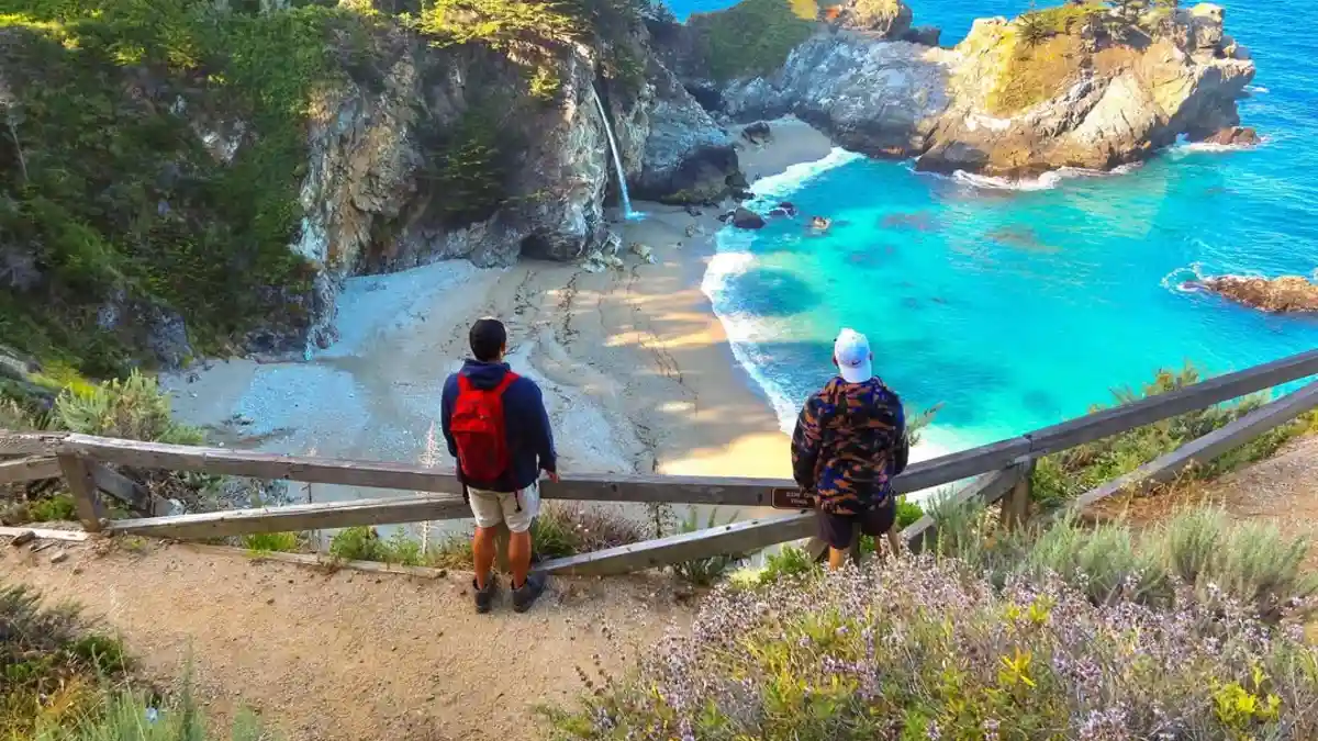
Most visitors drive straight to McWay Falls or Bixby Bridge without stopping at the state park. They assume the best Big Sur experiences happen along the coast. They’re missing something extraordinary.
The park entrance sits about 2 miles inland from Highway 1. Easy to miss if you’re focused on reaching famous coastal viewpoints. Look for the brown state park signs, not the flashy tourist attraction billboards.
Why It’s Hidden: Everyone Chases the Coastal Instagram Shots
Here’s what happens: Tourists come to Big Sur for dramatic ocean views and clifftop photos. They hit McWay Falls, Bixby Bridge, and Point Sur Lighthouse, then call it a day.
The redwood forest gets ignored. People forget that Big Sur contains some of California’s most magnificent old-growth trees. They’re so focused on coastline that they miss the forest cathedral.
Pfeiffer Falls doesn’t show up on most “must-see Big Sur” lists. Travel blogs focus on the photogenic coastal spots that generate clicks. A waterfall in the woods doesn’t compete with sunset shots over the Pacific.
The entry fee creates another barrier. Why pay $10 for a state park when you can see McWay Falls for free? That logic keeps casual tourists away and preserves the experience for people who appreciate forests.
Setting: 60-Foot Drop Through Ancient Redwood Cathedral
This waterfall offers something completely different from Big Sur’s coastal attractions. Instead of crashing ocean waves, you get the hushed silence of an ancient forest.
The 60-foot waterfall drops through a natural redwood cathedral. Trees that were already giants when Europeans first arrived tower overhead. Some of these redwoods are over 1,000 years old.
Sunbeams filter through the canopy like light through stained glass windows. When the angle is right, shafts of light illuminate the falling water while everything else stays in soft shadow.
The forest creates its own climate. Even on hot days, the redwood canopy keeps temperatures cool and humidity high. You’ll feel like you’re in a different world from the sunny coastline just miles away.
The scale puts you in perspective. Standing next to trees that are 200 feet tall and 12 feet wide makes you realize how small human problems really are.
Current Access: Valley View Trail (Direct Route Temporarily Closed)
The direct trail to Pfeiffer Falls is temporarily closed for repairs. This actually works in your favor because it keeps even more people away.
You can still reach the waterfall via the Valley View Trail. The route is longer but more scenic. You’ll see the Big Sur River valley from an elevated perspective that most visitors miss.
The combined hike is about 2 miles round-trip with gentle elevation gain. Perfect for families or anyone who wants beauty without suffering. The extra distance from the trail closure adds maybe 30 minutes total.
Follow signs for Valley View Trail from the main parking area. The path is well-marked and maintained. You can’t get lost unless you really try.
Bring layers even on warm days. The redwood forest creates its own microclimate that can be 10-15 degrees cooler than the parking lot.
Photography Tips: Winter and Spring Deliver the Best Flow
Winter and spring offer the strongest water flow when coastal rains feed the waterfall. December through April typically provides the most dramatic shots.
Here’s what local photographers know: The forest light is tricky but magical. Bring a camera that handles low light well, or use a tripod for longer exposures.
Early morning and late afternoon work best. Midday light gets blocked by the canopy and creates harsh shadows. Golden hour light filtering through redwoods is pure magic.
Don’t expect bright, colorful photos. The redwood forest creates a naturally muted color palette of greens and browns. Embrace the mood instead of fighting it.
Try shooting upward to capture the scale of the trees with the waterfall. The contrast between delicate falling water and massive tree trunks tells the story of this place.
Summer reduces the waterfall to a trickle, but the forest stays beautiful year-round. Even without strong water flow, the redwood setting justifies the visit.
Conservation Notes: Respect the Ancient Forest
These redwoods survived 1,000+ years of fires, floods, and climate changes. Don’t let your visit damage what took centuries to grow.
Stay on marked trails. Redwood roots are shallow and easily damaged. One shortcut can kill a tree that’s older than most civilizations.
Don’t carve initials or remove bark. These trees have natural defenses against disease, but human damage creates entry points for infections.
Keep noise levels down. The forest’s natural silence is part of the experience. Other visitors come here for peace, not your loud conversation.
Pack out all trash. The park staff works hard to maintain this pristine environment. Leave only footprints.
Why This Forest Cathedral Matters
Pfeiffer Falls proves that Big Sur offers more than just coastal scenery. While crowds fight for space at ocean viewpoints, you can experience something equally magnificent in complete tranquility.
The redwood forest represents thousands of years of natural history. These trees were already ancient when the Spanish first explored California. You’re walking through a living museum.
This isn’t just about seeing another waterfall. It’s about experiencing the spiritual power of old-growth forests that few places on Earth can provide.
The $10 entry fee is the best deal in Big Sur. You get access to one of California’s most magnificent forest cathedrals, plus a beautiful waterfall that most tourists never discover.
Take your time here. The coast will always be crowded, but this forest cathedral offers something money can’t buy: genuine peace in an ancient place.
7. Nojoqui Falls – Santa Barbara’s “Most Graceful” Hidden Gem
You’re visiting Santa Barbara wine country with your family. Everyone wants to see waterfalls, but the kids can’t handle serious hiking. Meanwhile, tour groups have overrun the few “easy” waterfalls you found online. There’s a perfect solution hiding between Solvang and the coast.
Location: Between Solvang and Gaviota Off Highway 101
Nojoqui Falls sits right off Highway 101, halfway between Solvang’s Danish tourist attractions and Gaviota’s beaches. Most people race past this exit without stopping.
The turnoff is easy to miss if you’re focused on reaching Solvang’s windmills or Santa Barbara’s coast. No big signs advertise this waterfall. Just a small brown sign for “Nojoqui Falls County Park.”
Take the Nojoqui Road exit and follow signs for about 3 miles. The road winds through oak-covered hills that look nothing like the crowded tourist areas nearby.
Why It’s Hidden: Locals Keep This One Quiet
Here’s the truth: Santa Barbara locals know about Nojoqui Falls, but they don’t advertise it. They prefer to send tourists to more famous spots while keeping this gem relatively peaceful.
Most visitors stick to the main attractions. Solvang’s Danish village pulls in crowds. Santa Barbara’s beaches and wineries get all the publicity. A small county park doesn’t compete with those big draws.
The location works against it too. It’s not quite in Solvang, not quite at the coast. Most people pick one destination and skip anything that seems like a detour.
Travel blogs focus on dramatic coastal waterfalls or challenging mountain hikes. A gentle family walk doesn’t generate the same clicks as extreme adventures.
Unique Geology: 80-Foot Travertine Formation Creates Something Special
Nojoqui Falls is completely different from granite waterfalls in the Sierra or basalt falls in Northern California. This one flows over travertine, a type of limestone that creates delicate, graceful formations.
The 80-foot drop doesn’t crash and thunder like mountain waterfalls. Instead, it creates a delicate veil that flows over white and cream-colored rock formations. The effect is more elegant than powerful.
Travertine forms when mineral-rich water deposits calcium carbonate over thousands of years. The result looks almost artificial – like someone designed the perfect waterfall backdrop.
Ferns and moss grow directly on the limestone, creating natural gardens behind the falling water. The whole scene looks more like a fairy tale than a typical California waterfall.
The water stays clear year-round because it filters through limestone before reaching the surface. Even during heavy rains, the falls maintain their graceful appearance.
Family-Friendly: 0.67-Mile Easy Walk Through Oak Woodland
This might be California’s most accessible beautiful waterfall. The trail is 0.67 miles each way with almost no elevation gain.
Perfect for families with young kids. No steep climbs, dangerous drop-offs, or technical sections. Even grandparents can make this walk comfortably.
The path winds through classic California oak woodland. Kids can look for acorns and spot different oak varieties. Spring brings wildflowers. Fall turns the leaves golden.
Bring a stroller if you want. The trail is wide and smooth enough for wheels, though you might need to lift it over a few small roots.
Plan 2-3 hours total including drive time and hanging out at the falls. Perfect for a morning or afternoon adventure that doesn’t consume your whole day.
Current Status: Check for Rockslide Closures
Here’s the honest truth: This waterfall occasionally closes due to rockslides. The same limestone geology that creates the beauty also creates some instability.
Check Santa Barbara County Parks website before making the drive. Closures can last weeks or months depending on the severity of rockfall.
Recent heavy rains increase the risk of closures. Call ahead during winter and early spring when storms are most likely.
When it’s open, the trail is completely safe. The county maintains it well and posts clear warnings if any sections become dangerous.
Don’t try to visit during posted closures. The limestone can be unpredictable, and county rangers take safety seriously.
What to Expect: Perfect for Photos and Picnics
The waterfall creates its own microclimate. Even on hot days, the limestone walls and falling water keep the area cool and humid.
Bring a camera that handles low light well. The canyon setting creates soft, even lighting that’s perfect for portraits but challenging for phone cameras.
The limestone formations provide natural seating areas. Perfect for picnics or just sitting quietly and enjoying the peaceful setting.
Don’t expect swimming. The pool at the bottom is shallow and rocky. This is more about enjoying the scenery than cooling off in the water.
Best Time to Visit: Winter and Spring for Flow, Fall for Comfort
Winter storms bring the strongest water flow. January through March typically offers the most dramatic display.
Spring provides the best combination of water flow and comfortable weather. April and May are ideal for family visits.
Summer reduces the waterfall significantly. It’s still beautiful, but you might find just a trickle instead of a substantial flow.
Fall offers the most comfortable hiking weather. Less water, but perfect temperatures and golden oak leaves.
Local Etiquette: Keep This Place Special
The small parking area fills up on weekends. If it’s full, don’t park on the road. Come back during the week instead.
Keep noise levels down. This is a peaceful place that locals use for quiet reflection. Loud groups change the whole atmosphere.
Pack out all trash. The county doesn’t have staff constantly cleaning this area. It stays beautiful because visitors respect it.
Don’t climb on the limestone formations. They’re more fragile than they look and can break under weight.
Why This Waterfall Matters
Nojoqui Falls proves that California’s best waterfalls aren’t always the biggest or most famous. Sometimes the most graceful experiences come in small, accessible packages.
This is the perfect introduction to waterfall hiking for families. Kids get a genuine adventure without exhausting themselves or their parents.
The unique geology offers something you can’t see anywhere else in California. Most waterfalls flow over granite or volcanic rock. This travertine formation is rare and beautiful.
Keep this place on your list for when you need an easy, beautiful escape that doesn’t require serious hiking commitment. Just remember to check for closures before making the drive.
8. Faery Falls – Mount Shasta’s Wildlife Refuge Secret
@du_xie_all_in_color
You’re searching for a waterfall that feels like true wilderness. Somewhere you won’t bump into Instagram influencers and crowded parking lots. Most “hidden” spots aren’t hidden anymore, but Faery Falls sits in a wildlife refuge that 99% of waterfall hunters have never heard of.
Location: Deep in Spenceville Wildlife Refuge
Faery Falls hides in Spenceville Wildlife Refuge, one of California’s least-visited protected areas. Most people have never heard of this refuge, even though it covers 11,000 acres of pristine habitat.
The refuge sits in the Sierra Nevada foothills, about an hour from Mount Shasta. No fancy visitor center, no gift shop, no paved parking lots. Just raw wilderness managed for wildlife, not tourists.
Getting there requires commitment. The dirt roads can be rough, especially after winter rains. High-clearance vehicles work best, though regular cars can make it if you drive carefully.
Why It’s Hidden: Wildlife Refuges Don’t Market to Tourists
Here’s the reality: Wildlife refuges exist for animals first, people second. They don’t advertise waterfalls or promote hiking because that’s not their mission.
Most outdoor websites focus on national parks and state parks. Wildlife refuges get ignored because they don’t have the marketing budgets or tourist infrastructure.
The access roads scare away casual visitors. No signs point you to waterfalls. You need to know exactly where you’re going before you arrive.
Cell service is nonexistent once you enter the refuge. That eliminates most people who depend on GPS apps to get around.
The remote location means you might not see another person all day. For many people, that’s terrifying rather than appealing.
Multi-Fall Access: Faery Falls Plus Beale Falls Bonus
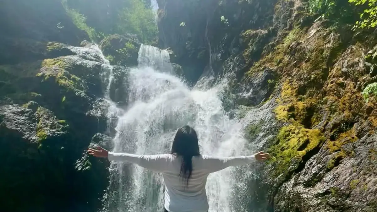
Faery Falls drops 41 feet over volcanic rock into a clear pool. The name fits – it looks like something from a fairy tale when wildflowers bloom around the base.
Beale Falls sits about a mile away. You can visit both in one trip if you plan your route carefully. Each waterfall shows how volcanic activity shaped this landscape millions of years ago.
The volcanic rock creates completely different formations than granite waterfalls in other parts of California. Dark basalt contrasts with white water and green vegetation.
Spring brings the most dramatic flows when snowmelt from higher elevations feeds both waterfalls. By midsummer, they might reduce to gentle trickles.
Each fall offers different photo opportunities. Faery Falls has the more dramatic drop. Beale Falls spreads across wider rock formations.
Remote Location Reality Check: This Isn’t a Casual Day Trip
Bring more water than you think you need. The refuge sits in rain shadow country that gets hot and dry. Dehydration happens fast at this elevation.
Don’t go alone. If something goes wrong, cell service won’t save you. Tell multiple people your exact plans and expected return time.
Pack a first aid kit and know how to use it. The nearest hospital is over an hour away on good roads. Longer if you need to drive slowly on rough refuge roads.
Bring extra food and emergency supplies. What starts as a day hike can turn into an overnight adventure if your car breaks down or you get lost.
The access roads can become impassable after heavy rains. Check conditions with the refuge office before making the drive, especially in winter and early spring.
Seasonal Access: Late Winter Through Early Summer
Late winter and spring offer the best waterfall flows. February through May typically provides the most water and the most dramatic displays.
Early summer works well for hiking comfort. June offers good weather with decent water flow. July starts to get hot and dry.
Fall and winter can be challenging. Rain makes the dirt roads muddy and potentially impassable. Snow is possible at higher elevations.
Wildlife activity peaks in spring and fall. You might see deer, wild turkeys, and dozens of bird species. Early morning and late afternoon offer the best animal viewing.
Wildflowers bloom in April and May. The volcanic soil supports unique plant communities that you won’t see in other parts of California.
What Wildlife Biologists Know About This Place
This refuge protects habitat for over 180 bird species. Some are rare or endangered species that depend on this specific ecosystem.
Keep noise levels down and move slowly. Wildlife spooks easily, especially during nesting season. Your quiet approach lets you see more animals.
Don’t feed any wildlife. Not even squirrels or chipmunks. Fed animals become dependent and aggressive, which often leads to their death.
Stay on existing trails even when they’re faint. The refuge ecosystem is more fragile than it looks. Off-trail hiking can damage habitat that takes years to recover.
Pack out everything you bring in. No trash pickup exists in the refuge. Animals can die from eating human food scraps or getting tangled in litter.
Safety Notes for Serious Backcountry
This is real wilderness with real risks. Mountain lions, bears, and rattlesnakes all live in the refuge. Know how to respond to wildlife encounters.
Weather can change fast at this elevation. Bring layers even on warm days. Afternoon thunderstorms are common in summer.
The volcanic rock can be sharp and unstable. Test each step when scrambling near the waterfalls. Loose rock can shift without warning.
Mark your route back to the car. The refuge has many faint trails that can confuse hikers. GPS units work better than phone apps in this remote area.
Why This Hidden Refuge Matters
Faery Falls represents what California wilderness looked like before tourism discovered it. No crowds, no facilities, no safety nets – just you and nature on nature’s terms.
This place survives because people respect it. Wildlife refuges operate on tiny budgets. They depend on visitors who follow rules and leave no trace.
The refuge protects an entire ecosystem, not just waterfalls. Your visit supports habitat conservation for dozens of species that can’t survive anywhere else.
This isn’t just about seeing another waterfall. It’s about experiencing genuine wilderness that requires respect, preparation, and responsibility. If you can handle that commitment, Faery Falls offers something almost extinct in California: true solitude in a pristine place.
9. Tenaja Falls – Riverside County’s “Way Off the Beaten Path” Multi-Tier Wonder
You want a waterfall that feels like true wilderness adventure. No crowds, no cell service, no safety nets – just you and nature. Most people aren’t willing to drive a terrifying one-lane road to get there. That’s exactly why Tenaja Falls stays empty.
Location: Cleveland National Forest Via Narrow, Winding Road
Tenaja Falls sits deep in Cleveland National Forest, accessible only by a road that scares away 90% of potential visitors. The final approach is one lane in many spots with steep drop-offs and no guardrails.
RVs and trailers can’t make it. The road is too narrow and has too many tight curves. Even regular cars require careful driving and nerves of steel.
The trailhead sits at the end of this challenging road, about 45 minutes from the nearest paved highway. No facilities, no cell service, no easy escape if things go wrong.
Why It’s Hidden: The Access Road Acts as a Perfect Filter
Here’s the brutal truth: Most people turn around before reaching the trailhead. The access road looks dangerous, and it kind of is.
The road climbs through chaparral-covered hills on a route that was never meant for heavy traffic. One lane with occasional pullouts for passing. Steep grades and tight curves that test your driving skills.
Even people who make it to the trailhead often leave quickly. The remote location and lack of facilities make many visitors uncomfortable.
No signs advertise this waterfall from main highways. You need to know exactly where you’re going and commit to the challenging drive before you start.
This natural filter ensures that only serious adventurers make it to Tenaja Falls. Casual tourists give up long before reaching the parking area.
Safety Considerations: This Is Serious Backcountry
Tell multiple people your exact plans and expected return time. If something goes wrong, nobody will find you quickly in this remote location.
Bring extra water, food, and emergency supplies. What starts as a day hike can turn into an overnight situation if your car breaks down or you get injured.
The nearest hospital is over an hour away. Basic first aid skills and a well-stocked kit aren’t optional – they’re survival tools.
Cell service is nonexistent. Your phone becomes a paperweight once you leave the main highway. Satellite communicators work better for emergencies.
The drive itself presents risks. Take the access road slowly. Pull over to let faster vehicles pass. Don’t attempt the drive in bad weather or after heavy rains.
Multi-Tiered System: Several Waterfalls Worth Exploring
Tenaja Falls isn’t just one waterfall – it’s a whole system of cascades. Multiple tiers drop through granite pools and smooth rock formations.
The main fall is the most dramatic. A 150-foot drop over granite cliffs into a deep pool. Perfect for photos and cooling off after the hot hike.
Several smaller falls cascade above and below the main drop. Each offers different photo opportunities and swimming spots. You could spend hours exploring all the tiers.
The granite formations tell a geological story. Smooth pools carved by thousands of years of water flow. Natural slides polished to perfection by seasonal floods.
Each tier creates its own microclimate. Some pools stay shaded and cool. Others bake in full sun and warm up for swimming.
Best Conditions: Winter and Spring After Heavy Rains
Winter storms bring the most dramatic water flow. January through March typically offers the most spectacular displays when the system roars to life.
Spring provides the best combination of water flow and hiking weather. April and May offer strong falls with comfortable temperatures.
Summer reduces the waterfalls significantly. By July, you might find just a trickle in the upper tiers. The lower pools usually hold water year-round.
Recent rainfall makes all the difference. Check weather reports before making the drive. A good storm can transform this place from dry creek bed to thundering cascade.
Fall can surprise you. Early season rains sometimes create unexpected flows in October or November.
What Search and Rescue Teams Know About This Place
Most problems happen on the access road, not the hiking trail. Flat tires, overheated engines, and vehicles stuck in soft dirt cause more rescues than hiking accidents.
Carry a full-size spare tire and basic tools. AAA can’t reach you here. You’ll need to solve car problems yourself or hike out for help.
The granite around the waterfalls gets slippery when wet. Test each step carefully. Smooth granite looks safe but can send you sliding into deep pools.
Flash floods are possible during heavy rains. Don’t camp in washes or near creek beds. High ground saves lives when desert storms hit.
Wildlife includes mountain lions and rattlesnakes. Know how to respond to dangerous animal encounters. Make noise while hiking to avoid surprising predators.
Camping and Extended Visits
Primitive camping is allowed in some areas. No facilities exist, so bring everything you need. Pack out all trash and human waste.
Check fire restrictions before bringing any stove or planning any campfire. This area burns easily and often. Current restrictions change based on weather and fire danger.
Water from the falls needs purification. Bring tablets or a filter. Even pristine-looking mountain water can carry harmful bacteria.
The night sky here is incredible. Far from city lights, you’ll see the Milky Way and thousands of stars. Worth the challenging access for astronomy lovers.
Why This Remote Wonder Matters
Tenaja Falls represents what California looked like before easy access changed everything. This place survives because it’s hard to reach and harder to exploit.
The challenging access protects the waterfall system from overuse. Only people who truly want to be here make the effort to visit.
This isn’t just about seeing waterfalls. It’s about testing yourself against genuine wilderness that doesn’t compromise for human convenience.
The multi-tier system offers something for everyone who makes it here. Photographers, swimmers, hikers, and solitude-seekers all find what they’re looking for.
Keep this place wild by respecting its rules. Pack out trash, stay on trails, and don’t share exact locations on social media. The remoteness that makes it special also makes it fragile.
If you’re ready for a real adventure that demands respect and preparation, Tenaja Falls offers an experience that’s becoming extinct in California. Just remember: with great beauty comes great responsibility.