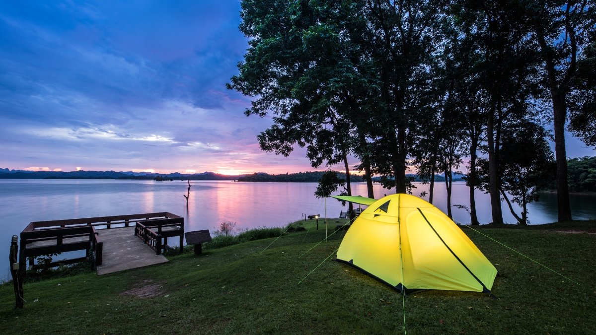
A secret network of pristine, completely free camping spots sits hidden across America’s public lands while millions of campers battle for reservations at overcrowded campgrounds,
Campground fees now hit $40-80+ per night, and 56.1% of campers can’t secure reservations at their preferred locations. You’re stuck camping elbow-to-elbow with generator noise and bright lights ruining the natural experience.
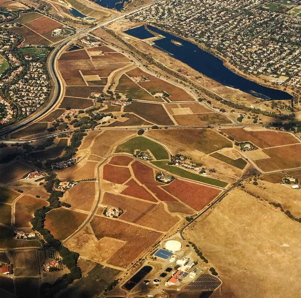
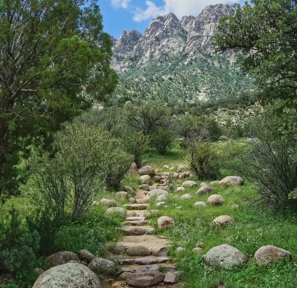
America’s BLM land and National Forest camping areas offer something better. These dispersed camping locations provide solitude, stunning views, and authentic outdoor experiences without crowds or costs.
This guide reveals 13 specific locations with GPS coordinates that locals keep secret. You’ll learn 2025 legal requirements, master apps that find similar hidden gems, and understand Leave No Trace principles that protect these areas.
Fair warning: these places stay special only when we protect them.
Why These Free Camping Spots Are “Jealously Guarded”
The Instagram Effect: From Secret to Swamped
Local campers and seasoned adventurers guard these hidden camping spots for good reason. What once took word-of-mouth decades to discover now spreads across Instagram in hours, transforming peaceful wilderness retreats into chaotic parking lots overnight.
The social media impact of camping has been devastating. Alabama Hills in California perfectly illustrates this phenomenon; once a quiet, dispersed camping area known mainly to locals and serious photographers.
After countless Instagram posts tagged the location, the site became so overrun that it now requires advance permits and strict regulations. What was once free and spontaneous became managed and restricted.
The Domino Effect on Public Lands
This pattern repeats across America’s public lands. Previously unknown spots featured in viral TikTok videos or Instagram reels attract thousands of inexperienced campers who often leave behind trash, create new unauthorized campsites, and overwhelm fragile ecosystems.
Local communities watch helplessly as their cherished retreats transform into overcrowded campgrounds that require expensive management and cleanup.
The Economics Behind the Secrecy
The economics tell the story clearly. With campground fees averaging $50-75 per night and 56.1% of campers unable to secure reservations at preferred locations, free alternatives become incredibly attractive. Over 245 million acres of BLM land sit available for dispersed camping, yet most people don’t know how to access these areas responsibly.
Locals fear that sharing these locations accelerates their destruction. They’ve witnessed too many pristine spots become overrun, forcing land managers to implement restrictions or close areas entirely. The result? A protective silence surrounds the best remaining hidden camping spots.
Their concerns aren’t unfounded; these places stay special only through careful stewardship and limited exposure.
Legal Requirements for Dispersed Camping in 2025
Understanding the 14-Day Rule
The most important BLM camping regulations center around the 14-day limit. You can camp for up to 14 days within any 28 days on BLM lands, but here’s the catch: these don’t have to be consecutive days.
The count begins the moment you occupy a site, and once you’ve used your 14 days, you must move at least 25 miles away from your previous location until day 29 arrives.
This rule exists to prevent permanent settlement on public lands and reduce environmental impact. Violating these dispersed camping rules can result in fines up to $1,000 and potential vehicle impoundment.
National Forest Variations
Free camping laws get more complex in National Forests, where regulations vary significantly by district. Most forests allow dispersed camping, but some have shorter limits, as little as 5 days in popular areas. Motor Vehicle Use Maps (MVUM) show exactly where camping is permitted and which roads are open to different vehicle types.
Always check with local ranger stations before setting up camp. Some districts prohibit camping within certain distances of developed areas, trails, or water sources.
Fire Restrictions and Seasonal Closures
Fire restrictions change rapidly based on weather conditions and can shut down entire regions with little notice. Stage 1 restrictions typically prohibit campfires but allow gas stoves, while Stage 2 bans all open flames. During extreme fire danger, entire forests may be closed to public access.
Winter closures affect high-elevation areas, with many forest roads becoming impassable due to snow. Always verify current conditions before traveling to remote locations.
Permit Requirements: The New Reality
California’s Alabama Hills now requires free permits year-round, obtained through Recreation.gov up to 5 months in advance. This shift from completely unrestricted to managed access reflects growing pressure on popular dispersed camping areas.
Long-Term Visitor Areas: Winter Haven
Arizona and California offer Long-Term Visitor Areas (LTVAs) where you can camp up to 7 consecutive months for just $180. These include Hot Spring, La Posa, Imperial Dam, and six other designated areas primarily serving winter visitors escaping cold climates.
LTVA permits run from September 15 to April 15, providing an affordable alternative to expensive RV parks in the Southwest.
Stay Legal, Stay Welcome
Understanding these regulations isn’t just about avoiding fines; it’s about preserving access for everyone. Areas with high violation rates often face increased restrictions or closure to camping entirely.
Essential Apps and Tools for Finding Hidden Free Camping
The Top Tier: Must-Have Apps
The best camping apps 2025 have evolved significantly, especially after FreeRoam shut down permanently earlier this year. Here’s what actually works now:
OnX Offroad dominates for serious campers. This paid app ($30/year) provides the most accurate public land boundaries, letting you verify you’re legally camping on BLM or Forest Service land.
The Dispersed Camping Layer shows existing sites with user reviews, while offline maps work without cell service. It’s the gold standard for land ownership verification.
Campendium offers the largest database of user-reviewed sites, both free and paid. The free version works well, but the $20/year upgrade adds cell coverage maps and public land overlays. Reviews include photos, GPS coordinates, and road condition reports from real campers.
The Dyrt Pro ($36/year) combines campground listings with dispersed sites. The public land overlays help identify legal camping zones, while user photos show exactly what to expect at each location.
Secondary Tools That Deliver
Gaia GPS provides professional-grade topographic maps with public land overlays. The offline capability makes it invaluable for remote scouting, though the interface requires a learning curve.
The Google Earth Technique
Here’s how experienced campers find free camping spots: Use Google Earth’s satellite view to identify potential sites along forest roads. Look for clearings, pullouts, and flat areas near existing roads. Cross-reference these spots with OnX Offroad to confirm they’re on public land and legal for camping.
Government Resources
Motor Vehicle Use Maps (MVUM) from the Forest Service show exactly which roads allow camping and what vehicle types can access them. These free PDFs are essential for legal compliance but require advanced downloading.
Planning for Connectivity
Cell coverage maps in Campendium and OnX Offroad help plan for work-from-camping scenarios. However, these maps aren’t always accurate; real-world testing is still necessary.
Pro Tip for 2025: Combine multiple dispersed camping apps rather than relying on one source. Cross-reference potential sites across platforms, and always verify current conditions with local ranger stations before traveling.
The 13 Most Jealously Guarded Free Camping Spots
1. Where Prairie Winds Meet Endless Sky: Scoria Pit, North Dakota
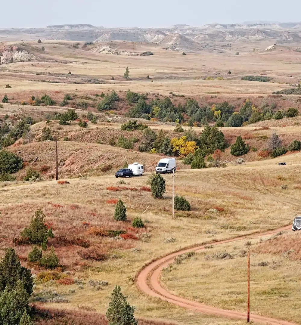
Featured in The Dyrt’s 2025 Best Places to Camp, Scoria Pit sits in Little Missouri National Grassland, offering true solitude with panoramic vistas. Bison herds graze within sight while prairie dogs create bustling underground cities.
It is accessible via a gravel road, but uneven terrain challenges RVs over 30 feet. High-clearance vehicles are recommended. Best seasons are May-October. Winter camping requires serious cold-weather prep.
It has first-come, first-served sites with no amenities. Bring all water, pack out waste. Strong winds are common; secure everything. Cell service is spotty to nonexistent. Red volcanic scoria rocks make excellent windbreaks.
2. California’s Secret High Country: Glass Mountain’s Hidden Refuge
This is high-elevation dispersed camping near Mammoth Lakes on Forest Service and BLM land. Elevation 7,000-9,000 feet creates cooler summer conditions. Obsidian deposits create unique geological formations.
High clearance is recommended. The area around 37.7669°N, 118.8334°W is for scouting. Access: June-October. Snow closes high elevations from November to May. Mammoth Lakes are 30 minutes away, and Bodie State Park, 45 minutes away.
Nights are cold even in summer. Altitude affects some visitors; arrive early to acclimate. Arrive midweek for the best site selection.
3. Grand Canyon’s Best-Kept Secret: Coconino Rim’s Forest Sanctuary
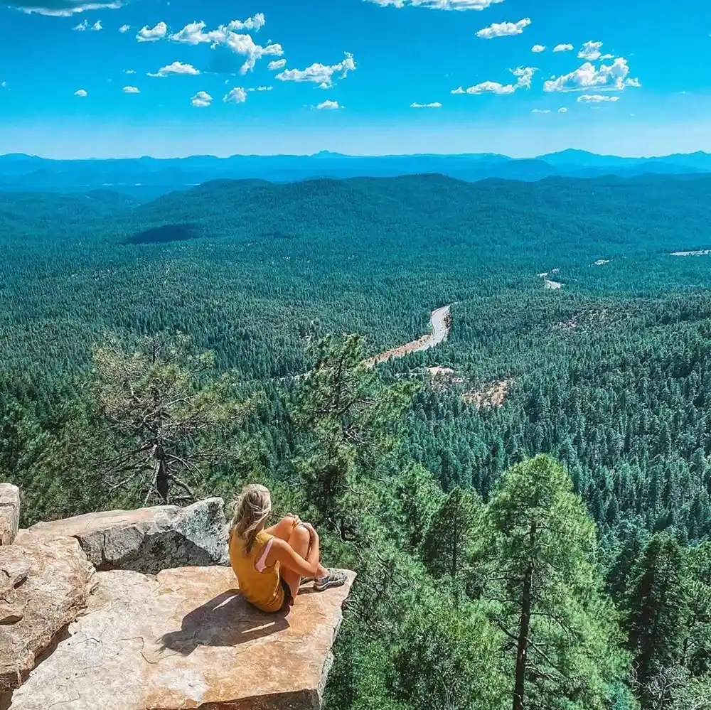
Kaibab National Forest has dispersed camping with a 4-5 bar cell signal. It accommodates big rigs up to 40+ feet. Elevation around 7,000 feet provides comfortable temperatures and forest shade.
Access: From Grand Canyon Village, north on AZ-64, then Forest Road 22 to Coconino Rim Road. Well-maintained gravel roads. The best seasons are May-October. Winter brings snow but fewer crowds.
The South Rim entrance is 45 minutes away. Best spots fill by Friday afternoon during peak season. Winter road conditions deteriorate rapidly during storms.
4. Desert Oasis with Natural Spas: Benton Hot Springs’ Hidden Valley
BLM lands around Benton Hot Springs with natural mineral springs access and exceptional dark skies. Elevation around 5,000 feet creates comfortable fall weather with cottonwood creek colors.
Access via US-6 and Benton Crossing Road. Most sites are RV-accessible, and high-clearance vehicles reach better spots. Several hot spring pools; respect private property. Best seasons: September-November.
Natural springs provide water but require purification. Hot springs are for soaking only. Some springs are clothing-optional; respect others’ comfort levels.
5. The Teton Range’s Shadow Sanctuary: Wyoming’s Hidden Mountain Gateway
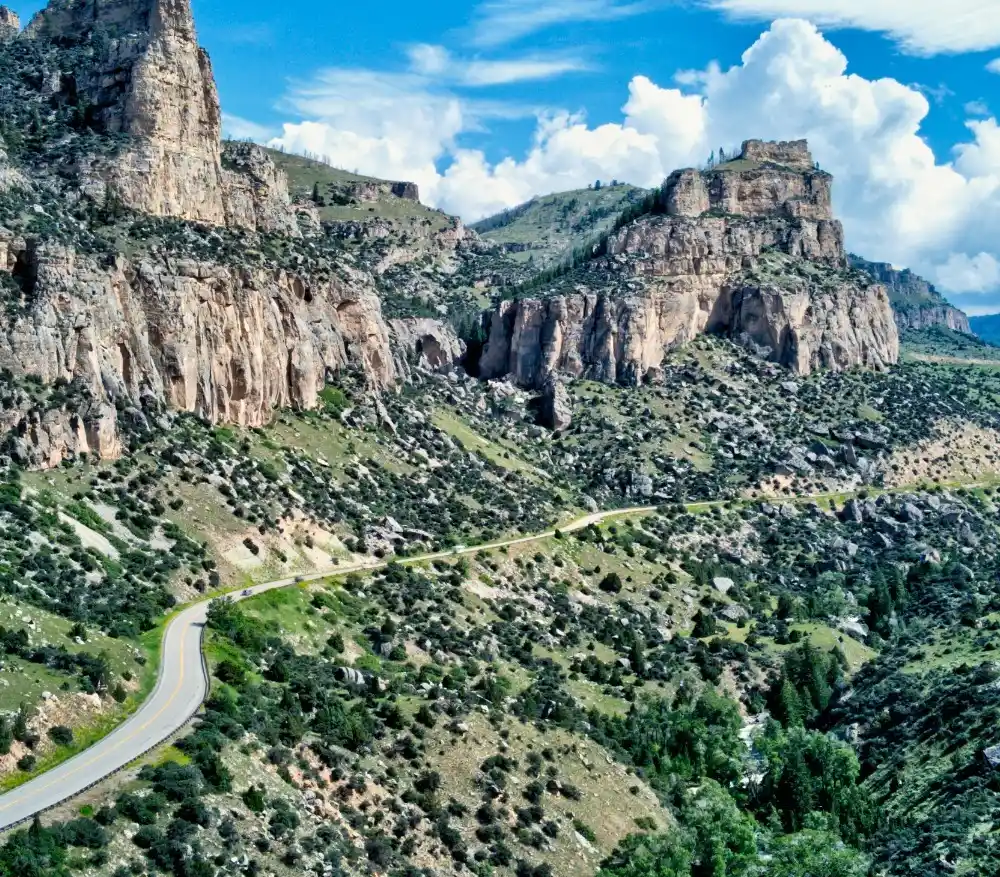
This is in the East of Grand Teton National Park, with mountain views rivaling the park interior. Rough road access deters crowds while remaining manageable for most vehicles. Campfires are allowed, unlike most of Grand Teton.
Forest roads are rough and rutted. High clearance recommended, but standard vehicles can make it with determination. Access: June-September. Snow blocks October-May.
It is active bear country; proper food storage is required, and carry bear spray. Mountain weather changes rapidly. The temperature drops 40+ degrees from day to night. Backcountry trails connect to the national park.
6. New England’s Autumn Glory: White Mountains River Refuge
White Mountain National Forest with 18 free spaces along a pristine river. Each site has a fire pit, space for 1-2 vehicles, flowing water soundtrack. Legendary during the fall foliage season.
Sites are along the Forest Road access. Peak colors are late September to early October. Fire rings and flat areas are at each site. Vault toilets are available. Excellent trout fishing is available, too. (license required).
It is strictly first-come, first-served. Arrive early Friday for weekend spots during peak foliage. Late spring through fall access.
7. Desert Peaks and Endless Stars: New Mexico’s Organ Mountains Hideaway
Ten mountain sites, 45 minutes from White Sands, 30 minutes from Las Cruces. Rough road access, but excellent cell signal. Fire pits enable evening gatherings under brilliant desert stars.
Rough, rocky roads require high-clearance vehicles. Bring extra water (1 gallon per person per day minimum). Multiple trails from camping areas. Best seasons: October-March.
Summer temperatures exceed 100°F regularly. Desert wildlife includes javelinas, roadrunners, and rattlesnakes. Shake out shoes and check around camp.
8. Front Row Seats to Ancient Wonders: Badlands Rim’s Secret Viewpoints
There is dry camping along the rim of Badlands National Park, offering sneak peek views of the formations. It has great cell service, making this great for remote work with stunning office views.
There are multiple rim road access points. Most sites handle RVs well. Direct park views are available without entrance fees. Buffalo Gap National Grassland provides overflow options.
Wind is constant and extreme; secure all gear. Summer thunderstorms are intense but brief. The best seasons are May-September. Winter brings bitter cold and strong winds.
9. Oregon’s Riverside Stargazing Paradise: The John Day River’s Hidden Gem
BLM site is at 44.7811°N, 119.6342°W along the John Day River. River access, excellent stargazing, Carroll Rim Trail access. Open landscape creates exceptional night sky viewing.
Excellent fishing for smallmouth bass and steelhead. Informal boat launching. The Carroll Rim Trail starts near the camp with panoramic views. Best seasons: April-October.
10. Bend’s Pine Forest Sanctuary (Currently Off-Limits): The China Hat Mystery
It is closed for county maintenance as of June 2025, with no reopening date. It previously offered excellent dispersed camping southeast of Bend on Forest Road 18.
Its alternatives in Deschutes National Forest are Forest Road 45 (Cascade Lakes area), Forest Road 46 (Century Drive), and Forest Road 42 (Cultus Lake direction).
County maintenance typically takes 6-18 months. Check with Deschutes National Forest for the current status.
11. Colorado’s Red Rock Cathedral: Black Ridge Canyons’ Wild Beauty
McInnis Canyons National Conservation Area with Colorado River views. Straddles the Colorado-Utah border, combining mountain desert with red rock country.
Access via Upper and Lower Black Ridge Roads, BS Road to Knowles and Jones Canyons. High clearance recommended. World-class mountain biking and hiking to natural arches.
Best seasons: Spring and fall. The summer is extremely hot, and winter is unpredictable. No reliable water sources; bring everything needed.
12. South Dakota’s Hidden Forest Island: Slim Buttes’ Remote Wilderness
The Custer National Forest combines pine forest with badlands formations. A mix of ecosystems creates unique wildlife viewing and photography opportunities.
It is truly isolated; the nearest services are over one hour away. Long gravel road access. High clearance is helpful but not required. No cell service, no amenities.
Extreme temperature swings are common. Prairie winds are intense. An emergency communication device is recommended for safety.
13. America’s Ultimate Island Escape: Goat Island’s Eagle-Watching Paradise
3-mile island is accessible only by boat from Myron Grove Boat Launch. Paddle approximately 2 miles. Exceptional bald eagle viewing is available, especially during migration.
Everything must be portaged by boat; pack light but bring weather protection. Life jackets are required. Check weather and water conditions before departure.
Best seasons: Late spring through early fall. Ice makes winter access impossible. Island location means weather exposure.
How to Find Your Own Secret Spots
The Google Earth Detective Method
Learning how to find free camping begins with becoming a digital detective. Open Google Earth and switch to satellite view, then zoom in on National Forest or BLM areas near your target destination. Look for clearings, pull-offs, and flat areas along forest roads; these often indicate existing campsites.
Scout camping spots by identifying telltale signs: circular clearings near roads, existing fire rings (visible as dark spots), tire tracks leading to flat areas, and disturbed ground patterns. These signs reveal where others have camped before, which is exactly what you want.
The Trailhead Treasure Hunt
Forest access roads and trailheads are goldmines for dispersed camping. Google Earth camping research should focus on secondary roads branching off main forest routes. Zoom in close enough to see individual trees; flat spots among the forest typically indicate potential campsites.
Search systematically: follow forest roads digitally, noting every pullout and clearing. Drop pins on promising locations, then cross-reference with public land boundaries using apps like OnX Offroad or Gaia GPS.
Land Ownership Verification
Never assume you can camp somewhere just because it looks suitable. Use OnX Offroad or similar apps to verify you’re on public land, not private property. Forest Service and BLM lands generally allow dispersed camping, but always check local regulations.
Motor Vehicle Use Maps (MVUM) from the Forest Service show exactly which roads allow camping and what vehicle types can access them. Download these free PDFs before heading out; they’re essential for legal compliance.
Scouting in Person
Always scout potential sites during daylight hours, even if you plan to arrive after dark. Drive slowly along forest roads, looking for established sites rather than creating new ones. Existing sites minimize environmental impact and are usually better positioned.
Look for these indicators of good existing sites: level ground, existing fire rings, room for your vehicle, distance from water sources (at least 200 feet), and natural windbreaks like trees or rocks.
The Leave-No-Trace Detective
Use existing disturbed areas whenever possible. Previous campers have already impacted these spots, so reusing them prevents creating new damage. Look for flattened vegetation, cleared tent areas, and established vehicle parking spots.
Check for “Leave No Trace” compliance: sites should be at least 100-200 feet from roads, trails, and water sources. Avoid camping in meadows, wetlands, or areas with fragile vegetation.
The best secret spots often require some effort to reach, but aren’t technically difficult. They’re close enough to roads for easy access but far enough to deter casual visitors.
Essential Gear for Off-Grid Camping
Water: Your Most Critical Resource
Dispersed camping gear starts with water storage and purification. Carry 1 gallon per person per day minimum, plus extra for cooking and cleanup. Collapsible containers save space when empty. Water purification tablets or portable filters handle questionable sources, but never rely solely on natural water availability.
Waste Management Solutions
Portable toilets are non-negotiable for responsible dispersed camping. Wag Bags use gelling agents and odor neutralizers to safely contain waste until proper disposal. PETT (Portable Environmental Toilet Technology) systems separate liquids from solids, reducing volume and odor. Biffy Bags offer a simpler single-use option. All systems pack out completely; never bury waste in popular areas.
Power Independence
Solar panels and battery systems keep devices charged without generators. A 100-watt solar panel with a lithium battery bank handles phones, tablets, and LED lights. Portable power stations provide AC outlets for larger devices. Always bring backup charging methods like hand-crank radios.
Boondocking Equipment Essentials
First aid kit with wilderness medicine supplies, multi-tool, duct tape, paracord, and LED headlamps with extra batteries. Fire-starting supplies, including waterproof matches and tinder. Folding shovel for waste disposal and campfire management.
Weather Protection by Region
Desert camping requires sun shade, extra water storage, and cold-weather gear for night temperature drops. Mountain locations need four-season sleeping systems and rain protection. Prairie areas demand serious wind protection and gear securing systems.
Emergency Communications
Off-grid camping supplies must include emergency communication devices. Satellite communicators like Garmin inReach provide two-way messaging and SOS capabilities where cell phones fail. Emergency whistles, signal mirrors, and bright flagging tape help rescuers locate you.
Leave No Trace Supplies
Pack dedicated cleanup supplies: trash bags, camp soap (biodegradable), sponges, and sanitizing wipes. Bring a camp broom to erase tire tracks and footprints. Carry out everything you bring in, including cigarette butts and food scraps.
Protecting These Spots: Leave No Trace Ethics
The Closure Crisis
Many free camping areas have closed permanently due to trash, vandalism, and environmental damage. Alabama Hills now requires permits, Shadow Mountain faces increasing restrictions, and countless unnamed spots get closed monthly. Leave No Trace camping isn’t just ethical; it’s the only way to keep these areas accessible.
Pack It Out, All of It
Responsible camping means everything that comes in, goes out. Pack out all trash, including cigarette butts, food scraps, and toilet paper. Human waste requires special handling: use Wag Bags or similar systems in popular areas. Never bury waste where others camp; pack it out completely.
Site Selection Rules
Camp 100-200 feet from roads, trails, and water sources. Use existing disturbed sites instead of creating new ones. Look for durable surfaces like rock, gravel, or already-impacted areas. Avoid fragile meadows, wetlands, and areas with cryptobiotic soil crusts.
Fire Safety and Responsibility
Use existing fire rings when available. If none exist, use a portable fire pan or mound fire technique. Never build new fire rings; they scar the landscape permanently. Completely extinguish fires with water, stir ashes, and feel for heat before leaving.
Wildlife and Cultural Respect
Store food properly to avoid attracting bears and other wildlife. Never feed animals or leave food scraps. Respect archaeological sites; don’t touch petroglyphs, move artifacts, or camp on cultural sites. These irreplaceable resources belong to everyone.
Reporting Problems
Report vandalism, illegal dumping, and resource damage to 1-800-637-9152. Your reports help land managers protect public lands and prosecute violators. Take photos when safe to do so, but prioritize personal safety.
Community Impact
Local communities bear the brunt when camping areas are left trashed. Respect private property boundaries, shop at local businesses when possible, and be courteous to residents. Their goodwill often determines whether access roads stay open.
The math is simple: these spots survive only when every visitor practices responsible camping. One person’s trash destroys the experience for thousands of future campers. Be the camper who leaves places better than you found them.
Conclusion
You now have access to 13 free camping spots America jealously guards, plus the tools to find countless more. OnX Offroad, Campendium, and Google Earth unlock dispersed camping from coast to coast.
Experience unmatched freedom, space, and solitude, free from crowds and costs. But these spots survive only through responsible use.
Alabama Hills now requires permits. Areas close monthly due to trash and damage. Every violation pushes these places closer to permanent closure.
Practice Leave No Trace and share responsibly; your next adventure depends on protecting these spots today.